Old Maps of Ferguson Corner, Wyoming for Metal Detecting
Plan your next treasure hunt with 8 historic maps of Ferguson Corner. Find old homesites, ghost towns, trails, and gathering spots that may be lost to time — perfect for identifying promising metal detecting locations.
- Locate forgotten sites: Uncover places like long-lost settlements, abandoned rail lines, or gathering spots.
- Plan better hunts: Use map overlays combined with LiDAR or satellite views to narrow in on historically rich areas.
- Made for detectorists: Thousands of hobbyists use these maps to discover relics, coins, and hidden history.
Use these historic maps to boost your research and find new opportunities beneath the surface of Ferguson Corner.
Ferguson Corner, WY maps
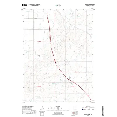
(8)- 1953 Map of Ferguson Corner, 1954 Print
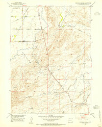 1953 Ferguson Corner1954 Print · USGSThe high plains of Platte County come into focus in the mid-1950s, showcasing a landscape defined by ranching and irrigation. Genealogists and historians can locate the Richeau School, the intersection at Ferguson Corner, and the path of the Southern (Burlington) railroad.2 unique versions available
 - 1954 Map of Cheyenne, 1963 Print
 1954 Cheyenne1963 Print · USGSSoutheastern Wyoming's high plains and the capital city's mid-century expansion are documented here during the early Cold War. Genealogists and historians can trace rail-aligned settlements like Pine Bluffs and Hillsdale, or explore landmarks like the Ames Monument and Francis E. Warren Air Force Base.3 unique versions available
 - 1958 Map of Cheyenne
 1958 Cheyenne1958 Print · USGSSoutheast Wyoming and the Nebraska border appear in the late 1950s as a hub of military defense and rail commerce. Genealogists can trace the Union Pacific through Cheyenne or locate the Horse Creek Oil Field and the State Capitol.2 unique versions available
 - 1990 Map of Ferguson Corner, 1995 Print
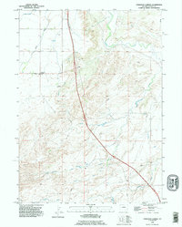 1990 Ferguson Corner1995 Print · USGSThe Platte County high plains come into focus in the 1990s, revealing a landscape of managed water and sparse settlement. Trace the course of the Bordeaux Canal and find landmarks like Ferguson Corner and Herman.
 - 2012 Map of Ferguson Corner, 2012 Print
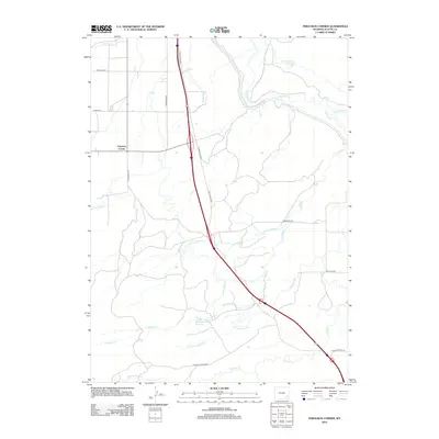 2012 Ferguson Corner2012 Print · USGSCovers Ferguson Corner, including Platte County, United States, and other nearby areas
 - 2015 Map of Ferguson Corner, 2015 Print
 2015 Ferguson Corner2015 Print · USGSCovers Ferguson Corner, including Platte County, United States, and other nearby areas
 - 2017 Map of Ferguson Corner, 2017 Print
 2017 Ferguson Corner2017 Print · USGSCovers Ferguson Corner, including Platte County, United States, and other nearby areas
 - 2021 Map of Ferguson Corner, 2021 Print
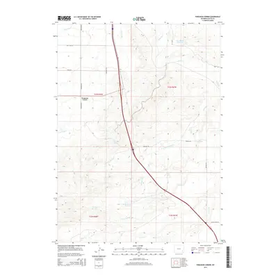
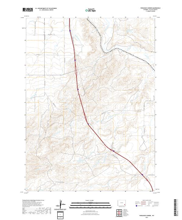 2021 Ferguson Corner2021 Print · USGSIn the open plains of Platte County, this recent survey shows the essential role of water management in the Wyoming landscape. Genealogists and researchers can trace family-named sites like the Bagley Brothers Reservoir and follow historical routes along Bordeaux Rd or Ferguson Rd.
End of results
Showing maps 1-8 of 8
Top cities near Ferguson Corner
Frequently asked questions
- What are the different types of historical maps available for Ferguson Corner?
- What is the oldest map of Ferguson Corner?
- Where can I purchase historical maps of Ferguson Corner for my home or office?
- Where can I download high-res historical maps of Ferguson Corner?
- Are there historical topographic maps available for Ferguson Corner?
- Is there historical aerial imagery available for Ferguson Corner?
- Where are historical maps of Ferguson Corner sourced from?