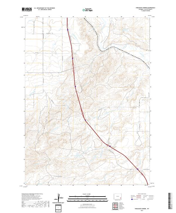
2021 Map of Ferguson Corner
USGS Topo · Published 2021About this map
Agricultural irrigation networks define the landscape of this Platte County region, as evidenced by the engineered path of the Highline Ditch and the Bordeaux Canal. The terrain is characterized by a series of drainages, including the prominent Chugwater Cr in the northeast and the branching systems of Antelope Cr. Smaller localized water management is visible through features like the Bagley Brothers Reservoir and Chug Springs Reservoir, which support the ranching and farming operations in these Wyoming plains. The road network follows a combination of section lines and the diagonal corridor of the S Wheatland Hwy, connecting outlying rural properties along Bordeaux Rd and Ferguson Rd. This 2021 survey illustrates how modern infrastructure continues to adapt to the natural contours of the northern high plains.
Find a feature on this map
28 named features on this map. Tap any name to fly to it.
Don’t see what you’re looking for? This feature index may not catch every label — zoom into the map to look around manually.
Map Details
Editions of this 2021 Ferguson Corner Map
This is the sole edition of this map. No revisions or reprints were ever made.
Other maps of this area

1896 · Hartville
USGS Topo · 1:125,000

1901 · Hartville
USGS Topo · 1:125,000

1951 · Antelope Gap
USGS Topo · 1:24,000
1951 · Wheatland
USGS Topo · 1:24,000

1953 · Double L Ranch
USGS Topo · 1:24,000

1953 · Chugwater
USGS Topo · 1:24,000

1953 · Hightower
USGS Topo · 1:24,000

1953 · Natwick
USGS Topo · 1:24,000

1953 · Ferguson Corner
USGS Topo · 1:24,000

1953 · Bordeaux
USGS Topo · 1:24,000