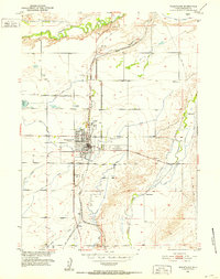
1951 Map of Wheatland
USGS Topo · Published 1952About this map
The Colorado and Southern (Burlington Route) anchors the development of this Platte County landscape, running parallel to the north-south alignment of U.S. 87. Centered on the growing hub of Wheatland, the map reveals a sophisticated irrigation network vital to high-plains agriculture, featuring the Laramie River No 1 Ditch, City Ditch, and Highline Canal. Small rail-side points like Whiting and Gibson contrast with the larger ranching operations, such as Phifer Ranch and Bard Ranch, that define the outskirts of the settlement.
Find a feature on this map
39 named features on this map. Tap any name to fly to it.
Don’t see what you’re looking for? This feature index may not catch every label — zoom into the map to look around manually.
Map Details
Editions of this 1951 Wheatland Map
2 editions found
Other maps of this area

1896 · Hartville
USGS Topo · 1:125,000

1901 · Hartville
USGS Topo · 1:125,000

1951 · Dwyer
USGS Topo · 1:24,000

1951 · Antelope Gap
USGS Topo · 1:24,000
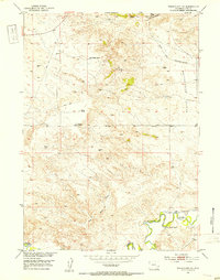
1951 · Wheatland NE
USGS Topo · 1:24,000

1953 · Lewis Flat
USGS Topo · 1:24,000

1953 · Hightower
USGS Topo · 1:24,000

1953 · Natwick
USGS Topo · 1:24,000

1953 · Ferguson Corner
USGS Topo · 1:24,000

1953 · Bordeaux
USGS Topo · 1:24,000