
1953 Map of Lewis Flat
USGS Topo · Published 1954About this map
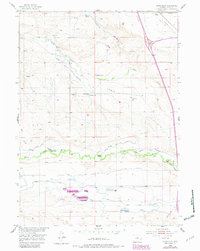
North Laramie Canal and Mitchell Ditch cut across this high-plains landscape in 1953, reflecting an era of intensive water management for cattle ranching in Platte County. The map centered on Lewis Flat documents a network of family-operated holdings such as Lewis Ranch, Patterson Ranch, and the Old Mitchell Home Ranch. These ranches are supported by a complex irrigation system including Reservoir No 1 and Reservoir No 2, which divert water from the North Laramie River. Rural social infrastructure is evident at the centrally located Lewis School, serving the scattered agricultural community. The terrain is further defined by ephemeral drainages like Fish Creek and various windmills dotting the hills, essential for livestock survival in this semi-arid environment. This survey captures the height of the mid-century ranching economy before modern consolidation shifted the local footprint.
Find a feature on this map
21 named features on this map. Tap any name to fly to it.
Don’t see what you’re looking for? This feature index may not catch every label — zoom into the map to look around manually.
Map Details
Editions of this 1953 Lewis Flat Map
2 editions found
Other maps of this area

1896 · Hartville
USGS Topo · 1:125,000

1901 · Hartville
USGS Topo · 1:125,000

1950 · Coleman Butte
USGS Topo · 1:24,000

1950 · Herman Ranch
USGS Topo · 1:24,000

1950 · Cottonwood Falls
USGS Topo · 1:24,000

1951 · Coleman Butte
USGS Topo · 1:24,000

1951 · Cottonwood Falls
USGS Topo · 1:24,000
1951 · Herman Ranch
USGS Topo · 1:24,000

1951 · Dwyer
USGS Topo · 1:24,000
1951 · Wheatland
USGS Topo · 1:24,000