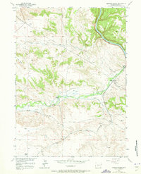
1950 Map of Coleman Butte
USGS Topo · Published 1963About this map
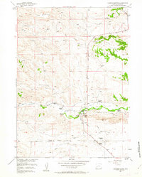
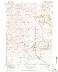
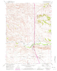
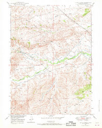
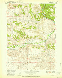
High plains ranching life in Platte County is documented in this mid-century survey, centered on the landmark Coleman Butte and the surrounding drainages. The landscape is defined by its water sources and family operations, with a cluster of estates along Cottonwood Creek including the M L Coleman Ranch and the H B Coleman Ranch. The Cottonwood Community Hall serves as a social anchor for the remote settlers of this region, which is further shaped by the rugged elevations of Table Mountain and Pine Ridge. A network of unimproved roads and numerous Windmills trace the vital infrastructure required for livestock in this environment. The map provides a detailed look at the rural land use and genealogy of the area, featuring named properties such as the Willadsen Ranch, Adams Ranch, and Vermilyea Ranch situated between Crow Creek and Fletcher Park Creek.
Find a feature on this map
25 named features on this map. Tap any name to fly to it.
Don’t see what you’re looking for? This feature index may not catch every label — zoom into the map to look around manually.
Map Details
Editions of this 1950 Coleman Butte Map
3 editions found
Other maps of this area

1896 · Hartville
USGS Topo · 1:125,000

1901 · Hartville
USGS Topo · 1:125,000
1949 · Spring Creek
USGS Topo · 1:24,000

1950 · Spring Creek
USGS Topo · 1:24,000
1950 · Herman Ranch
USGS Topo · 1:24,000
1950 · Cottonwood Falls
USGS Topo · 1:24,000

1951 · Coleman Butte
USGS Topo · 1:24,000
1951 · Sibley Peak
USGS Topo · 1:24,000
1951 · Cottonwood Falls
USGS Topo · 1:24,000
1951 · Herman Ranch
USGS Topo · 1:24,000