
1951 Map of Coleman Butte
USGS Topo · Published 1951About this map
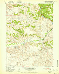
Family ranching and communal life define the landscape of Platte County at the start of the 1950s, centered around the landmark Coleman Butte. The map reveals a tight-knit agricultural network along the winding Cottonwood Creek, anchored by the Cottonwood Community Hall. The presence of multiple generations or branches of a single family is evident in the cluster of the M L Coleman Ranch, H B Coleman Ranch, and Harry Coleman Ranch. Further out, the Fletcher Ranch and Willadsen Ranch mark the expansion of grazing and irrigation into the surrounding hills. This survey, part of the Missouri River Basin development program, meticulously documents the water sources vital to this high-plains economy, including numerous unnamed windmills and specific waterways like South Bear Creek and Crow Creek. The terrain transitions from the broad Table Mountain in the north to the distinctive wooded escarpment of Pine Ridge.
Find a feature on this map
21 named features on this map. Tap any name to fly to it.
Don’t see what you’re looking for? This feature index may not catch every label — zoom into the map to look around manually.
Map Details
Editions of this 1951 Coleman Butte Map
This is the sole edition of this map. No revisions or reprints were ever made.
Other maps of this area

1896 · Hartville
USGS Topo · 1:125,000

1901 · Hartville
USGS Topo · 1:125,000

1949 · Spring Creek
USGS Topo · 1:24,000

1950 · Spring Creek
USGS Topo · 1:24,000

1950 · Coleman Butte
USGS Topo · 1:24,000

1950 · Herman Ranch
USGS Topo · 1:24,000

1950 · Cottonwood Falls
USGS Topo · 1:24,000

1951 · Sibley Peak
USGS Topo · 1:24,000

1951 · Cottonwood Falls
USGS Topo · 1:24,000
1951 · Herman Ranch
USGS Topo · 1:24,000