
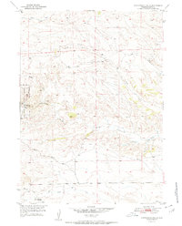
1951 Map of Cottonwood Falls
USGS Topo · Published 1951About this map
Medicine Bow National Forest dominates the western edge of this landscape, where the terrain breaks into the drainage systems of the Laramie Range. This 1951 study, conducted as part of the Department of the Interior's Missouri River Basin development program, shows a sparse ranching and forestry environment defined by seasonal watercourses like Cottonwood Creek and Crow Creek. The map records a specific moment of transition for local infrastructure, notably marking the Fish Creek Sch (Aband) at the southern boundary, indicating the consolidation or shift of rural education in Platte County. Settlement is concentrated around Cottonwood Falls, with remote Windmills and the Fletcher Park Road providing the primary evidence of human activity among the draws and ridges.
Find a feature on this map
13 named features on this map. Tap any name to fly to it.
Don’t see what you’re looking for? This feature index may not catch every label — zoom into the map to look around manually.
Map Details
Editions of this 1951 Cottonwood Falls Map
2 editions found
Other maps of this area

1943 · Esterbrook
USGS Topo · 1:62,500

1945 · Esterbrook
USGS Topo · 1:62,500

1949 · Spring Creek
USGS Topo · 1:24,000

1950 · Spring Creek
USGS Topo · 1:24,000

1950 · Coleman Butte
USGS Topo · 1:24,000

1950 · Cottonwood Falls
USGS Topo · 1:24,000

1951 · Coleman Butte
USGS Topo · 1:24,000

1951 · Sibley Peak
USGS Topo · 1:24,000

1953 · Lewis Flat
USGS Topo · 1:24,000

1953 · Johnson Mountain
USGS Topo · 1:24,000