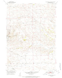
1951 Map of Cottonwood Falls
USGS Topo · Published 1951About this map
Medicine Bow National Forest occupies the western edge of this mid-century survey, where the drainages of the Laramie Range carve a complex network of canyons and draws. This document was produced as part of the Department of the Interior's Missouri River Basin development program, following field checks in 1950. The landscape is defined by its watercourses, including the prominent Cottonwood Creek and Crow Creek, which dictate the local topography. Human presence is sparse, marked primarily by the Fletcher Park Road and isolated infrastructure like the Fish Creek Sch (Aban'd), reflecting the remote ranching and timber character of this portion of Platte County. Genealogists and local historians may find interest in the transition from active use to abandonment seen in the labeling of school sites and the placement of several Windmill symbols across the high country.
Find a feature on this map
13 named features on this map. Tap any name to fly to it.
Don’t see what you’re looking for? This feature index may not catch every label — zoom into the map to look around manually.
Map Details
Editions of this 1951 Cottonwood Falls Map
2 editions found
Other maps of this area

1943 · Esterbrook
USGS Topo · 1:62,500

1945 · Esterbrook
USGS Topo · 1:62,500

1949 · Spring Creek
USGS Topo · 1:24,000

1950 · Spring Creek
USGS Topo · 1:24,000

1950 · Coleman Butte
USGS Topo · 1:24,000

1950 · Cottonwood Falls
USGS Topo · 1:24,000

1951 · Coleman Butte
USGS Topo · 1:24,000

1951 · Sibley Peak
USGS Topo · 1:24,000

1951 · Cottonwood Falls
USGS Topo · 1:24,000

1953 · Lewis Flat
USGS Topo · 1:24,000