Old Maps of Riner, Wyoming for Metal Detecting
Plan your next treasure hunt with 11 historic maps of Riner. Find old homesites, ghost towns, trails, and gathering spots that may be lost to time — perfect for identifying promising metal detecting locations.
- Locate forgotten sites: Uncover places like long-lost settlements, abandoned rail lines, or gathering spots.
- Plan better hunts: Use map overlays combined with LiDAR or satellite views to narrow in on historically rich areas.
- Made for detectorists: Thousands of hobbyists use these maps to discover relics, coins, and hidden history.
Use these historic maps to boost your research and find new opportunities beneath the surface of Riner.
Riner, WY maps
(11)- 1954 Map of Rawlins, 1968 Print
 1954 Rawlins1968 Print · USGSThe high plains and mountain ranges of southern Wyoming are shown here in the mid-1950s as the Union Pacific railroad and early highways fueled local industry. Genealogists and historians can trace old homesteads and outposts like the Overland Stage Station, the Utah Oil Refining Station, and the Hadsell Winter Headquarters.2 unique versions available
 - 1958 Map of Rawlins
 1958 Rawlins1958 Print · USGSSouthern Wyoming at the mid-century shows a landscape defined by the Union Pacific Railroad and the high basins of the Continental Divide. Researchers can trace old transportation routes near Fort Fred Steele or explore the mining history around Hanna and Medicine Bow.2 unique versions available
 - 1962 Map of Rawlins
 1962 Rawlins1962 Print · USGSSouthern Wyoming at the dawn of the sixties shows a landscape shaped by the Union Pacific and the high peaks of the Medicine Bow Mountains. Researchers can trace the path of the old stage routes through Overland Stage Station and Fort Fred Steele.
 - 1966 Map of Riner, 1969 Print
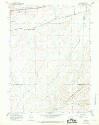 1966 Riner1969 Print · USGSRailroad operations along the Union Pacific define this mid-century Wyoming landscape at the Carbon County line. Genealogists and historians can trace the remote sidings at Riner and Fillmore or locate water sources like Piker Spring and Separation Creek.2 unique versions available
 - 1967 Map of Rawlins
 1967 Rawlins1967 Print · USGSCentral Wyoming and northern Colorado in the 1980s are defined here by the Union Pacific corridor and the high peaks of the Sierra Madre. Researchers can trace the legacy of old mining and rail towns like Carbon, Hanna, and Medicine Bow along the Overland Trail.
 - 1984 Map of Rawlins
 1984 Rawlins1984 Print · USGSRawlins and the high-desert basins of Carbon County are shown in the mid-1980s as a vital transportation and energy corridor. Researchers can trace the historic Overland Trail and locate coal operations like Cherokee Mine No. 1 and the State Penitentiary.
 - 1988 Map of Rawlins
 1988 Rawlins1988 Print · USGSSouthern Wyoming and the Colorado borderlands are detailed here in the late eighties, featuring the intersection of the historic Overland Trail and the Union Pacific. Researchers can trace old rail towns like Medicine Bow and Wamsutter or landmark peaks like Medicine Bow Peak.
 - 2012 Map of Riner, 2012 Print
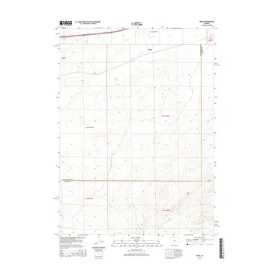
 2012 Riner2012 Print · USGSCovers Riner, including Sweetwater County, Carbon County, and other nearby areas
 - 2015 Map of Riner, 2015 Print
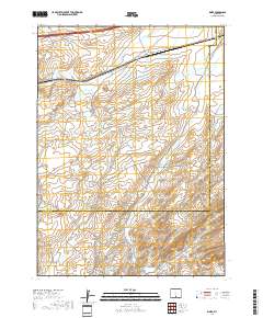
 2015 Riner2015 Print · USGSCovers Riner, including Sweetwater County, Carbon County, and other nearby areas
 - 2017 Map of Riner, 2017 Print
 2017 Riner2017 Print · USGSCovers Riner, including Sweetwater County, Carbon County, and other nearby areas
 - 2021 Map of Riner, 2021 Print
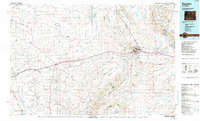
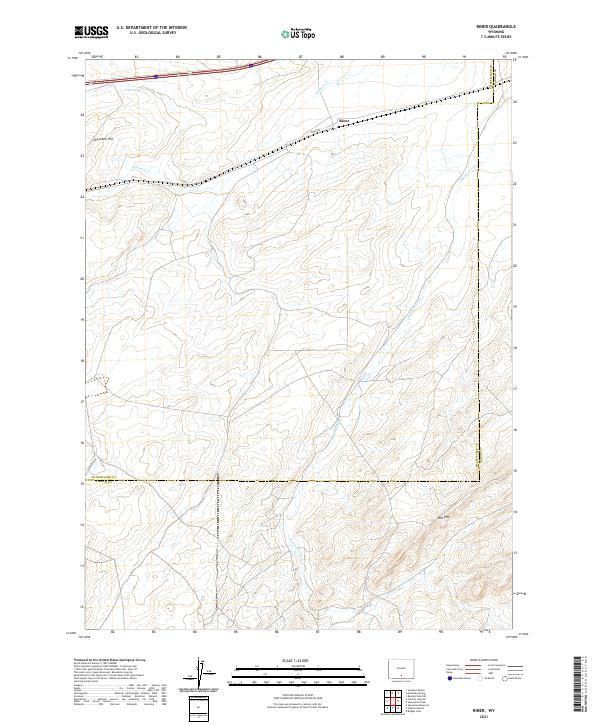 2021 Riner2021 Print · USGSSweetwater and Carbon counties meet here in the 2020s, showing a high-plains landscape shaped by sparse water and long roads. Local researchers can trace the drainages of Separation Cr and landmarks like Cherokee Hill or the remote outpost of Riner.
End of results
Showing maps 1-11 of 11
Frequently asked questions
- What are the different types of historical maps available for Riner?
- What is the oldest map of Riner?
- Where can I purchase historical maps of Riner for my home or office?
- Where can I download high-res historical maps of Riner?
- Are there historical topographic maps available for Riner?
- Is there historical aerial imagery available for Riner?
- Where are historical maps of Riner sourced from?