Old Maps of Hoback, Wyoming for Genealogy
Trace your family roots with 36 historic maps of Hoback. These high-res maps reveal old neighborhoods, homesites, landmarks, and streets — helping you uncover where your ancestors lived and how the area evolved over time.
- Explore historic neighborhoods: Identify where your relatives may have lived in the 1800s or 1900s.
- Compare maps over time: Trace the changes in streets, buildings, and landmarks for multi-generational research.
- Perfect for genealogy & ancestry research: Used by family historians and researchers to map out lineage and migration.
These maps are an incredible resource for exploring your personal connection to Hoback's past.
Hoback, WY maps
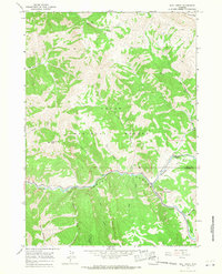
(36)- 1931 Map of Jackson, 1961 Print
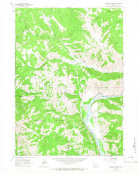
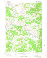
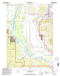
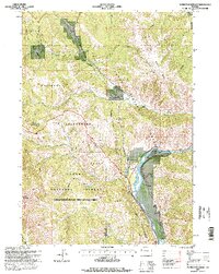
 1931 Jackson1961 Print · USGSJackson and the upper Snake River canyon are documented here in the early thirties, showcasing a wilderness era of ranching and forestry. Researchers can trace early outposts like Browns Ranch or locate family history at the Etna Cem and Johnny Counts Flat.
 - 1935 Map of Jackson
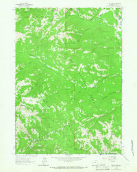
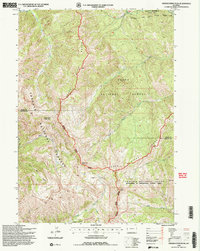
 1935 Jackson1935 Print · USGSThe high valleys of the Teton and Gros Ventre ranges are captured here in the mid-thirties, showing the early infrastructure of the upper Snake River region. Researchers can locate early schools and ranching outposts like Porcupine Sch, Browns Ranch, and the Jackson Mine.2 unique versions available
 - 1955 Map of Driggs, 1967 Print
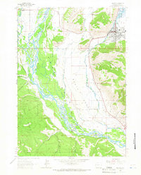
 1955 Driggs1967 Print · USGSEastern Idaho and Western Wyoming appear at a mid-century crossroads as the river valleys were fully settled and the high peaks protected. Genealogists and researchers can trace the rail towns of Rexburg and Driggs or follow the Snake River from Irwin to the Palisades Reservoir.3 unique versions available
 - 1958 Map of Driggs
 1958 Driggs1958 Print · USGSThe high Teton peaks and Snake River valleys are captured here in the mid-fifties, showing the region's agricultural and wilderness boundaries. Researchers can trace the Union Pacific rail corridor through Rexburg or locate early settlements like Clementsville and Tetonia.2 unique versions available
 - 1962 Map of Driggs
 1962 Driggs1962 Print · USGSThe Idaho-Wyoming borderlands are captured here in the early sixties, showing the peaks and valleys of the northern Rockies. Genealogists and historians can trace rail lines like the Union Pacific RR and isolated outposts like the National Elk Refuge or the Fort Hall Indian Reservation.
 - 1963 Map of Munger Mountain, 1966 Print
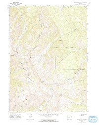
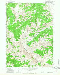
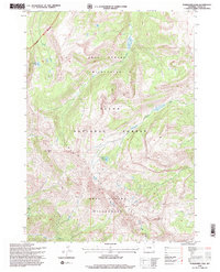
 1963 Munger Mountain1966 Print · USGSThe high country of the Teton Range and Snake River canyon is captured here in the early 1960s. Researchers can locate remote sites like the Bureau of Public Roads Camp, the Astoria Mineral Hot Springs, and the high-elevation Landing Strip.2 unique versions available
 - 1963 Map of Jackson, 1966 Print
 1963 Jackson1966 Print · USGSJackson Hole and the Snake River valley are captured here in the early sixties as the regional infrastructure began to expand. Genealogists and local historians can trace early town footprints in Jackson and Wilson, or locate landmarks like Boyles Hill and the National Elk Refuge.3 unique versions available
 - 1963 Map of Teton Pass, 1966 Print
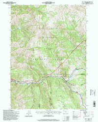
 1963 Teton Pass1966 Print · USGSThe high passes of the Wyoming-Idaho border are documented here in the early sixties, showing the rugged crossing between the national forests. Researchers can locate Elliott Cem, the settlement of Wilson, and historic routes like the Mail Trail.3 unique versions available
 - 1963 Map of Observation Peak, 1966 Print
 1963 Observation Peak1966 Print · USGSThe Snake River Range at the height of the 1960s is shown in this detailed study of the Wyoming high country. Trace the network of primitive routes like the Pack Trail through North Indian Creek Pass or find landmarks like Observation Peak and Lake Basin.2 unique versions available
 - 1965 Map of Camp Davis, 1968 Print
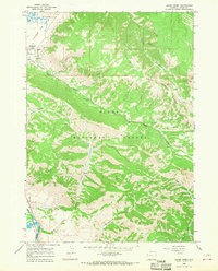
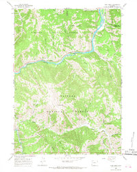
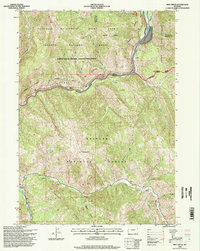
 1965 Camp Davis1968 Print · USGSThe Snake and Hoback rivers meet in this 1960s Wyoming survey, showing the region before modern development altered the mountain corridors. Genealogists and historians can locate early landmarks like Camp Davis, Lafayette Sta, and the sulfurous waters of Stinking Springs.
 - 1965 Map of Turquoise Lake, 1968 Print
 1965 Turquoise Lake1968 Print · USGSThe Gros Ventre Range is captured in the mid-1960s, showing the high-country landscape of the Teton National Forest. Trace primitive routes like the Highline Trail past landmarks such as Turquoise Lake, Cache Peak, and the Ski Cabin.2 unique versions available
 - 1965 Map of Cache Creek, 1968 Print
 1965 Cache Creek1968 Print · USGSThe peaks of the Gros Ventre Range tower over the Snake River valley in the mid-sixties, showing the rugged boundary between federal forest and wildlife refuge. Researchers can trace the steep paths of Jackson Mine and Noker Mine or locate the Refuge Hdqrs near the base of Nowlin Peak.2 unique versions available
 - 1965 Map of Bailey Lake, 1968 Print
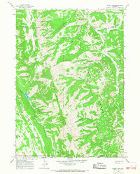 1965 Bailey Lake1968 Print · USGSThe high Wyoming wilderness of the mid-1960s is preserved here, showing the remote intersection of two national forests. Trace the isolation of early backcountry outposts like Rimrock Ranch and Adams, or navigate the high terrain of Grayback Ridge.2 unique versions available
 - 1965 Map of Bull Creek, 1968 Print
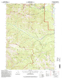
 1965 Bull Creek1968 Print · USGSTeton and Sublette counties are captured here in the mid-1960s, showing a rugged wilderness defined by the river corridor and high peaks. Researchers can trace early recreational sites like Hoback Campground or locate the remote Mine near Granite Creek.
 - 1965 Map of Pine Creek, 1968 Print
 1965 Pine Creek1968 Print · USGSThe Snake River canyon area in the mid-1960s shows a landscape of national forests and river-driven geography before modern development. Outdoorsmen and researchers can trace the old Pack Trails and locate historical sites like Pine Bar and the Forks Campground.
 - 1981 Map of Jackson
 1981 Jackson1981 Print · USGSThe high valleys and peaks surrounding Jackson were undergoing subtle transitions in the early eighties. Genealogists and researchers can trace old mountain outposts like Bondurant, the location of Camp Davis, and the roads leading to Astoria Mineral Hot Springs.
 - 1996 Map of Cache Creek, 1998 Print
 1996 Cache Creek1998 Print · USGSTeton County was a landscape of high-mountain wilderness and conservation at the close of the twentieth century. Researchers can trace the development of Jackson and locate historic mining sites such as the Jackson Mine and Noker Mine near the peaks of the Gros Ventre Range.
 - 1996 Map of Jackson, 1998 Print
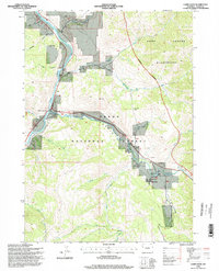
 1996 Jackson1998 Print · USGSJackson and the Snake River valley appear here in the mid-1990s as the region's ranching roots met modern growth. Researchers can trace land use from Elk Refuge and Wilson to local landmarks like Aspen Hill Cemetery and the Melody Ranch.
 - 1996 Map of Camp Davis, 1998 Print
 1996 Camp Davis1998 Print · USGSThe confluence of the Snake and Hoback Rivers comes alive in the mid-nineties, showing the intersection of forest life and canyon ranching. Genealogists and historians can trace family-named sites like Broken Arrow Ranch, Lafayette Station, and Camp Davis.
 - 1996 Map of Turquoise Lake, 1998 Print
 1996 Turquoise Lake1998 Print · USGSThe Gros Ventre Range in the late nineties is a landscape of high summits and seasonal camps. Outdoor historians can trace the Highline trail past Turquoise Lake and locate remote outposts like the Ski Cabin and Hunting Camp near Blackrock Creek.2 unique versions available
 - 1996 Map of Bull Creek, 1998 Print
 1996 Bull Creek1998 Print · USGSThe Teton backcountry in the late twentieth century reveals a landscape of high peaks and protected wilderness near the Teton-Sublette county line. Researchers can trace the river corridor and mountain access points through Camp Davis, the Hoback Shield Trail, and Battle Mountain.
 - 1996 Map of Munger Mountain, 1998 Print
 1996 Munger Mountain1998 Print · USGSThe Snake River corridor and the Teton and Lincoln county lines are captured here in the late nineties. Researchers can locate Astoria Mineral Hot Springs, the settlement of Hoback, and remote landmarks like the Rock Quarry or Red Top Meadows.
 - 1996 Map of Observation Peak, 1998 Print
 1996 Observation Peak1998 Print · USGSHigh Wyoming wilderness along the Snake River Range is captured in the 1990s as it appeared before modern developments. Researchers can trace remote mountain routes through North Indian Creek Pass and landmark summits like Observation Peak and Indian Peak.2 unique versions available
 - 1996 Map of Teton Pass, 1998 Print
 1996 Teton Pass1998 Print · USGSThe Teton and Snake River Ranges converge at this high-altitude crossing in the mid-1990s. Local researchers can trace family landmarks and mountain infrastructure including Elliott Cem, Wilson, and the Trail Creek Ranch.
 - 1996 Map of Pine Creek, 1998 Print
 1996 Pine Creek1998 Print · USGSThe Grand Canyon of the Snake River and the Greys River confluence are the focal points of this mid-nineties Forest Service revision. Trace the river-side network of campsites like Station Creek Camp or locate high-country landmarks including Elk Mountain.
Showing maps 1-25 of 36
Top cities near Hoback
Top neighborhoods of Hoback
Frequently asked questions
- What are the different types of historical maps available for Hoback?
- What is the oldest map of Hoback?
- Where can I purchase historical maps of Hoback for my home or office?
- Where can I download high-res historical maps of Hoback?
- Are there historical topographic maps available for Hoback?
- Is there historical aerial imagery available for Hoback?
- Where are historical maps of Hoback sourced from?