1970s Maps of Weston County, Wyoming
Explore 16 historic maps of Weston County from the 1970s. These maps offer a rare glimpse into what life looked like during the 1970s — showing old roads, neighborhoods, homes, and landmarks that have changed or disappeared over time.
Whether you're researching your family's past, planning a metal detecting trip, or studying how Weston County's landscape evolved across the 1970s, these high-resolution maps are a powerful tool for exploring the history of this region.
- Focus on a specific era: All maps on this page are from the 1970s, giving you a focused view of this time period.
- See what’s changed: Compare century-old streets, trails, and buildings to today's modern landscape using overlays and satellite layers.
- Research with precision: Use these maps for genealogy, historical research, land use analysis, or educational projects.
- View, download, or print: Maps are fully viewable online in high resolution, and can be downloaded or printed for your own records.
Start exploring Weston County's history through authentic maps from the 1970s. This is your window into the past.
Weston County, WY maps
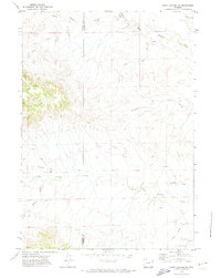
(16)- 1971 Map of Fiddleback Ranch, 1974 Print
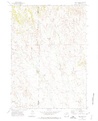
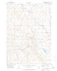
 1971 Fiddleback Ranch1974 Print · USGSThe high plains of Converse County come into focus during the early 1970s, showing a remote ranching landscape where the Cheyenne River meets its tributaries. Researchers can locate established homesteads like the Fiddleback Ranch and trace the course of Sauerkraut Draw through the Rochelle Hills.
 - 1971 Map of Piney Canyon NE, 1974 Print
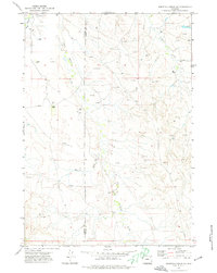
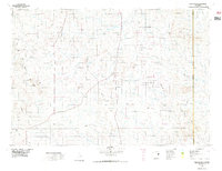
 1971 Piney Canyon NE1974 Print · USGSNortheast Wyoming in the early 1970s reveals a sparse ranching and energy landscape at the border of Campbell and Weston Counties. Local historians can trace the paths of Keeline Road and Little Thunder Road to isolated landmarks like Small Ranch.
 - 1971 Map of Whitetail Creek SE, 1974 Print
 1971 Whitetail Creek SE1974 Print · USGSThe high plains of the Campbell and Weston County border in the early seventies show a landscape of isolated ranching and growing energy infrastructure. Genealogists and historians can locate family landmarks like Pickrel Ranch or Baker Ranch and trace the early Oil Wells near Raven Creek.
 - 1971 Map of Piney Canyon SE, 1974 Print
 1971 Piney Canyon SE1974 Print · USGSThe Weston County ranchlands come into focus during the early seventies, showing a landscape defined by its remote canyons and drainage networks. Genealogists and historians can trace the family footprint at Spencer Ranch or locate the Graves and Mine sites near Piney Creek.
 - 1971 Map of Jim Creek, 1975 Print
 1971 Jim Creek1975 Print · USGSThe Wyoming prairie near the Campbell and Weston County line is captured here in the early seventies, detailing a remote ranching landscape. Researchers can trace local landmarks like Harold Place, Jay, and the rugged depths of Hells Canyon.
 - 1971 Map of Whitetail Creek NE, 1975 Print
 1971 Whitetail Creek NE1975 Print · USGSNortheastern Wyoming in the early seventies shows a landscape heavily shaped by energy production at the tri-county junction. Researchers can trace the footprints of the Duvall Ranch Oil Field, a remote Landing Strip, and the winding Belle Fourche River.
 - 1971 Map of Buck Creek, 1975 Print
 1971 Buck Creek1975 Print · USGSThe high plains along the Campbell and Weston county line in the early seventies show a landscape shaped by water and energy. Researchers can trace the winding paths of Buck Creek and Big Thunder Creek or locate industrial markers like the Pipeline and early Drill Hole sites.
 - 1972 Map of Gillette, 1975 Print
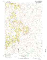
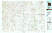
 1972 Gillette1975 Print · USGSGillette and the surrounding Campbell County prairies are shown during a decade of intense energy expansion in the 1970s. Researchers can trace the early footprint of the Wyodak Strip Mines and locate rural landmarks like Antelope Butte and Rozet.
 - 1972 Map of Pedro, 1977 Print
 1972 Pedro1977 Print · USGSWeston County ranching and energy sectors are on display in the early 1970s, as development clustered along the rail lines and creek beds. Genealogists and historians can trace the Burlington Northern route through the Pedro Oil Field and past local landmarks like Home Ranch Spring.
 - 1972 Map of Osage, 1977 Print
 1972 Osage1977 Print · USGSOsage and its surrounding oil fields are captured here in the early 1970s, showcasing the industrial backbone of Weston County. Genealogists and historians can trace the intersection of the Burlington Northern railroad with local landmarks like the Power Plant and Claypits.
 - 1972 Map of Klodt Reservoir, 1977 Print
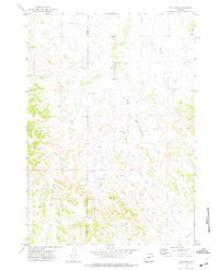
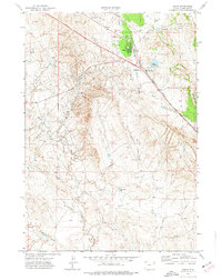
 1972 Klodt Reservoir1977 Print · USGSWeston County was a hub of energy development in the early 1970s, as seen in this detailed survey of the high plains. Researchers can trace the network of the Mush Creek Pumping Sta, numerous Oil Well sites, and the namesake Klodt Reservoir.
 - 1974 Map of Reno Junction, 1975 Print
 1974 Reno Junction1975 Print · USGSThe high plains of eastern Wyoming in the mid-1970s reveal an era of intensive energy production and remote ranching life. Genealogists and historians can trace the footprint of petroleum industry landmarks like the Hilight Oil and Gas Field alongside old settlements like Savageton and Reno.2 unique versions available
 - 1974 Map of Gillette, 1993 Print
 1974 Gillette1993 Print · USGSGillette and the Powder River Basin are captured here in the mid-seventies during a pivotal era of energy development. Genealogists and historians can trace the early footprint of the Wyodak Strip Mines and the rail-side growth of Rozet and Wyodak.
 - 1979 Map of Newcastle
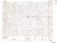
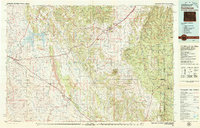
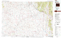 1979 Newcastle1979 Print · USGSThe energy-rich plains of Weston County meet the Black Hills in the late seventies as oil production and ranching define the landscape. Researchers can trace the Burlington Northern rail lines and explore the vast Fiddler Creek Oil Field or the remote Darlington School.
 - 1979 Map of Sundance
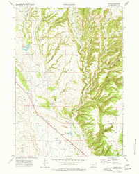
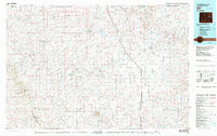
 1979 Sundance1979 Print · USGSThe Black Hills borderlands in the late 1970s show a region of high peaks and vital rail corridors connecting Wyoming to South Dakota. Researchers can trace historic routes and industry through settlements like Clay Spur, Upton, and the Historical Monument.2 unique versions available
 - 1979 Map of Bill, 1980 Print
 1979 Bill1980 Print · USGSConverse County and the surrounding ranchlands are shown in the late 1970s as industrial mining began to reshape the cattle country. Researchers can trace the Burlington Northern rail line and locate landmarks like the Johnston Mine, Bill, and Red Butte.2 unique versions available
End of results
Showing maps 1-16 of 16
Top cities of Weston County
Frequently asked questions
- What are the different types of historical maps available for Weston County?
- What is the oldest map of Weston County?
- Where can I purchase historical maps of Weston County for my home or office?
- Where can I download high-res historical maps of Weston County?
- Are there historical topographic maps available for Weston County?
- Is there historical aerial imagery available for Weston County?
- Where are historical maps of Weston County sourced from?