Old Maps of Weston County, Wyoming for Metal Detecting
Plan your next treasure hunt with 142 historic maps of Weston County. Find old homesites, ghost towns, trails, and gathering spots that may be lost to time — perfect for identifying promising metal detecting locations.
- Locate forgotten sites: Uncover places like long-lost settlements, abandoned rail lines, or gathering spots.
- Plan better hunts: Use map overlays combined with LiDAR or satellite views to narrow in on historically rich areas.
- Made for detectorists: Thousands of hobbyists use these maps to discover relics, coins, and hidden history.
Use these historic maps to boost your research and find new opportunities beneath the surface of Weston County.
Weston County, WY maps
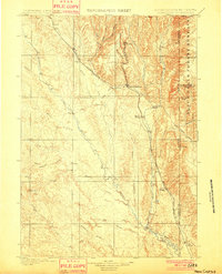
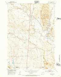
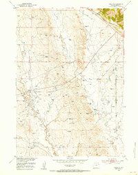
(142)- 1898 Map of Sundance
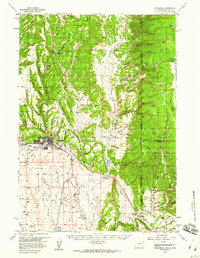
 1898 Sundance1898 Print · USGSNorthwestern Wyoming and the Black Hills border come alive in the 1890s, when Sundance served as a key regional hub. Genealogists and local historians can trace early wagon routes connecting settlements like Manhattan, Welcome, and Inyankara.
 - 1899 Map of Newcastle, 1964 Print
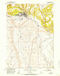
 1899 Newcastle1964 Print · USGSThe Wyoming-South Dakota borderlands appear here at the close of the nineteenth century, as railroads and ranching reshaped the Black Hills. Researchers can trace early cattle operations like YT Ranch and mining infrastructure at Cambria and Newcastle.
 - 1901 Map of Newcastle
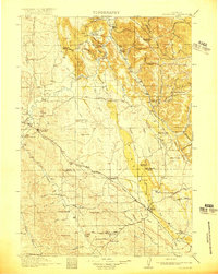
 1901 Newcastle1901 Print · USGSThe Wyoming-South Dakota borderlands come alive in this survey conducted just before the turn of the century, centered on the railroad hub of Newcastle. Genealogists and historians can trace early cattle history at Lak Ranch and the industrial spur leading to the coal-mining town of Cambria.3 unique versions available
 - 1902 Map of Sundance
 1902 Sundance1902 Print · USGSThe Wyoming and South Dakota borderlands come into focus at the turn of the century as ranching and early mining outposts take hold. Genealogists and historians can trace family-named sites like Mc Creadys Ranch and early settlements including Manhattan and Buckhorn.4 unique versions available
 - 1918 Map of Moorcroft
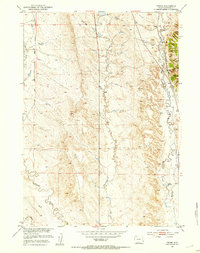
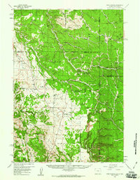
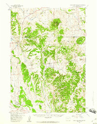
 1918 Moorcroft1918 Print · USGSNortheastern Wyoming’s ranching and railroad landscape is captured here just before the end of the Great War. Genealogists can locate nearly twenty rural schoolhouses, including the Dakota Ridge School, while following the Chicago Burlington and Quincy rail line through Thornton and Upton.2 unique versions available
 - 1951 Map of Owens, 1953 Print
 1951 Owens1953 Print · USGSEastern Wyoming ranching and rail corridors are captured here in the early fifties. Genealogists and local historians can trace the Chicago Burlington and Quincy line past Owens and the M W Ranch.3 unique versions available
 - 1951 Map of Dewey, 1953 Print
 1951 Dewey1953 Print · USGSCrossing the state line during the early fifties, this map captures the railroad-dependent life of the Wyoming-South Dakota borderlands. Genealogists and historians can trace the rail corridor between Dakoming and Dewey or locate the Lucky Strike Bentonite Mine.4 unique versions available
 - 1951 Map of Dewey SW, 1953 Print
 1951 Dewey SW1953 Print · USGSEastern Wyoming ranching and early energy development are captured here in the early fifties. Researchers can trace land use through features like the Artesian Well, Oil Wells, and the path of Robbers Roost Creek.2 unique versions available
 - 1951 Map of Newcastle, 1953 Print
 1951 Newcastle1953 Print · USGSThe railroad town of Newcastle is captured here in the early fifties, showing the interplay of canyon terrain and valley settlement. Genealogists and historians can locate Greenwood Cem, the local Fairground, and the siding at Spencer.3 unique versions available
 - 1951 Map of Morrisey NE, 1953 Print
 1951 Morrisey NE1953 Print · USGSWeston County ranching and early energy development are captured in the early fifties before the landscape fully modernized. Researchers can trace the legacy of the M Bar Ranch and locate early resource markers like the Oil Well (Inactive) and several Windmill sites.2 unique versions available
 - 1951 Map of Fanny Peak, 1953 Print
 1951 Fanny Peak1953 Print · USGSThe Wyoming and South Dakota borderlands come into focus in the early 1950s, highlighting the rugged terrain where the Black Hills meet the high plains. Researchers can trace the layout of the L A K Ranch, locate the Sweet School, and identify high-altitude points like Fanny Peak.4 unique versions available
 - 1951 Map of Osage SE, 1953 Print
 1951 Osage SE1953 Print · USGSWeston County at the dawn of the 1950s shows a landscape transitioning into a major energy corridor. Family researchers and historians can locate the Boulden Ranch and trace early petroleum infrastructure like the Oil Pump Sta and the Chicago Burlington and Quincy rail line.4 unique versions available
 - 1951 Map of Clifton, 1953 Print
 1951 Clifton1953 Print · USGSThe Wyoming and South Dakota borderlands come into focus in the early 1950s as a high-altitude ranching and rail corridor. Researchers can trace the Chicago Burlington and Quincy line past the Clifton School and family sites like Blaine Ranch.4 unique versions available
 - 1954 Map of Gillette, 1975 Print
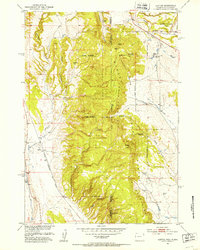
 1954 Gillette1975 Print · USGSGillette and the northeast Wyoming ranching country are captured here in the mid-1950s as coal and bentonite mining shaped the local economy. Genealogists can trace family landmarks like the Bethlehem Church, Wellman School, and early settlements along the Chicago Burlington and Quincy RR.
 - 1955 Map of Newcastle, 1963 Print
 1955 Newcastle1963 Print · USGSThe high plains of eastern Wyoming and western South Dakota are captured in the mid-fifties, showing a landscape of sprawling ranches and emerging oil fields. Researchers can locate family landmarks like Saunders Ranch, trace the Chicago Burlington & Quincy RR, and explore small rail towns such as Osage and Edgemont.2 unique versions available
 - 1955 Map of Gillette, 1976 Print
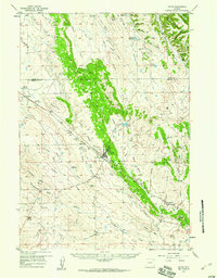
 1955 Gillette1976 Print · USGSNortheastern Wyoming in the mid-twentieth century is captured here as the energy and ranching landscape began to shift. Genealogists and historians can trace the foundations of local communities through sites like Wyodak, the Pleasantdale Community Building, and landmarks like Devils Tower National Monument.
 - 1957 Map of Upton, 1959 Print
 1957 Upton1959 Print · USGSUpton and the surrounding Weston County high plains are captured here in the late fifties during a period of steady rail and industrial activity. Researchers can trace the Chicago Burlington and Quincy line past Thornton to Bentley, locating old Clay Pits and family-named features like Mc Crady Draw.2 unique versions available
 - 1958 Map of Gillette
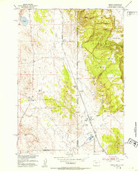
 1958 Gillette1958 Print · USGSNortheastern Wyoming and the Black Hills are captured here in the late fifties, showcasing a landscape of high-plains ranching and emerging energy production. Researchers can trace the rail-side growth of Gillette and find historic rural landmarks like the Wyodak Coal Mine, Bethlehem Church, and Devils Tower National Monument.2 unique versions available
 - 1958 Map of Newcastle
 1958 Newcastle1958 Print · USGSThe high plains of eastern Wyoming meet the Black Hills in the late fifties, showcasing a landscape of rail-connected towns and historic trails. Trace the path of the Chicago Burlington & Quincy RR through Newcastle or locate the Bozeman Trail Monument and Summitt Ridge Lookout Tower.
 - 1958 Map of Four Corners, 1960 Print
 1958 Four Corners1960 Print · USGSThe Black Hills borderlands in the late fifties reveal a high-prairie landscape where Wyoming meets South Dakota. Genealogists and researchers can trace family landmarks and rural life at the St Albert Ch, Boyd Cem, and the settlement at Four Corners.2 unique versions available
 - 1958 Map of Newcastle, 1960 Print
 1958 Newcastle1960 Print · USGSNewcastle and the eastern Wyoming borderlands are captured here during a period of infrastructure growth and ranching stability. Genealogists and historians can locate family-named landmarks like the LAK Ranch, the historic Cambria mining area, and the Greenwood Chapel.2 unique versions available
 - 1958 Map of Inyan Kara Mountain, 1960 Print
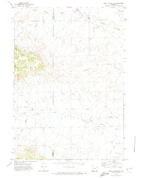
 1958 Inyan Kara Mountain1960 Print · USGSThe Black Hills of Wyoming in the late fifties show a landscape of high timbered ridges and early industrial development. Genealogists and historians can locate rural landmarks like Davis Sch and the unique Historical Graves (Two of Custers Men).3 unique versions available
 - 1962 Map of Gillette
 1962 Gillette1962 Print · USGSHigh plains ranching and coal mining dominate the Powder River Basin in the early sixties. Genealogists can trace rural communities through landmarks like the Bethlehem Church, Lake School, and settlements such as Moorcroft and Sundance.
 - 1971 Map of Fiddleback Ranch, 1974 Print
 1971 Fiddleback Ranch1974 Print · USGSThe high plains of Converse County come into focus during the early 1970s, showing a remote ranching landscape where the Cheyenne River meets its tributaries. Researchers can locate established homesteads like the Fiddleback Ranch and trace the course of Sauerkraut Draw through the Rochelle Hills.
 - 1971 Map of Piney Canyon NE, 1974 Print
 1971 Piney Canyon NE1974 Print · USGSNortheast Wyoming in the early 1970s reveals a sparse ranching and energy landscape at the border of Campbell and Weston Counties. Local historians can trace the paths of Keeline Road and Little Thunder Road to isolated landmarks like Small Ranch.
Showing maps 1-25 of 142
Top cities of Weston County
Frequently asked questions
- What are the different types of historical maps available for Weston County?
- What is the oldest map of Weston County?
- Where can I purchase historical maps of Weston County for my home or office?
- Where can I download high-res historical maps of Weston County?
- Are there historical topographic maps available for Weston County?
- Is there historical aerial imagery available for Weston County?
- Where are historical maps of Weston County sourced from?