1980s Maps of Weston County, Wyoming
Explore 40 historic maps of Weston County from the 1980s. These maps offer a rare glimpse into what life looked like during the 1980s — showing old roads, neighborhoods, homes, and landmarks that have changed or disappeared over time.
Whether you're researching your family's past, planning a metal detecting trip, or studying how Weston County's landscape evolved across the 1980s, these high-resolution maps are a powerful tool for exploring the history of this region.
- Focus on a specific era: All maps on this page are from the 1980s, giving you a focused view of this time period.
- See what’s changed: Compare century-old streets, trails, and buildings to today's modern landscape using overlays and satellite layers.
- Research with precision: Use these maps for genealogy, historical research, land use analysis, or educational projects.
- View, download, or print: Maps are fully viewable online in high resolution, and can be downloaded or printed for your own records.
Start exploring Weston County's history through authentic maps from the 1980s. This is your window into the past.
Weston County, WY maps
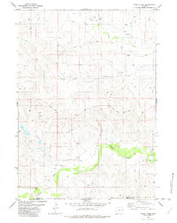
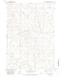
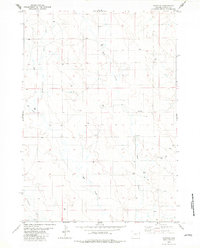
(40)- 1981 Map of Wagonhound Creek
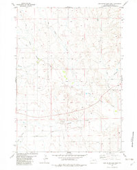
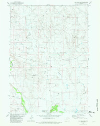
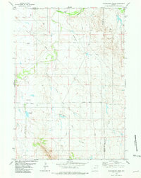 1981 Wagonhound Creek1981 Print · USGSEastern Wyoming ranching country is captured here in the early 1980s, centered on the Dull Center community. Researchers can trace local landmarks like Nachtman Sch and family-named features including Dull Reservoir and Nachtman Reservoir.
 - 1981 Map of Wagonhound Creek NE
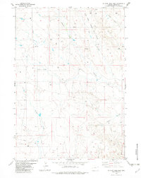
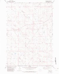
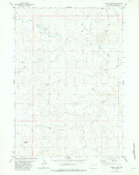
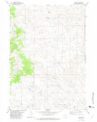
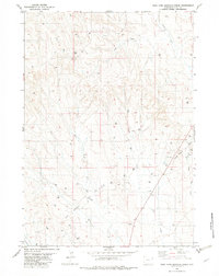
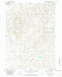 1981 Wagonhound Creek NE1981 Print · USGSThe high plains of Niobrara County come into focus during the early 1980s, revealing a landscape shaped by water and oil. Researchers can trace energy exploration through numerous Oil Wells and Drill Holes near Lance Creek and the Cheyenne River.
 - 1981 Map of Lance Creek, 1983 Print
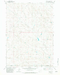
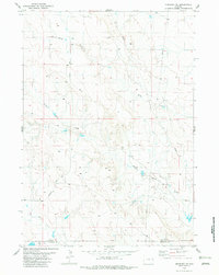
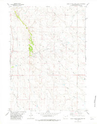
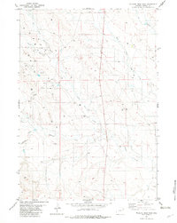
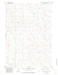
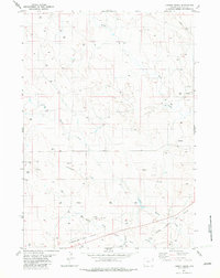
 1981 Lance Creek1983 Print · USGSEastern Wyoming at the start of the 1980s reveals a high-plains landscape dominated by the energy industry and complex drainage systems. Researchers can trace the footprints of the Kaye Oil Field and Clareton Oil Field or follow the waters of the Cheyenne River and Robbers Roost Creek.
 - 1982 Map of Spyglass Hill
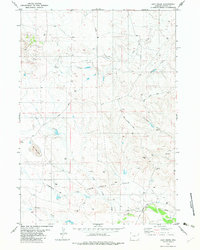
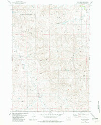
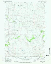
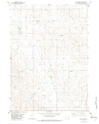
 1982 Spyglass Hill1982 Print · USGSCrook and Weston County ranchlands meet the Wyoming oil patch in the early eighties. Researchers can trace the development of the Coyote Creek Oil Field and the Burlington Northern rail line near Spyglass Hill.
 - 1982 Map of Freda Creek
 1982 Freda Creek1982 Print · USGSThe energy frontier of northeast Wyoming comes into focus here in the early 1980s. Trace the industrial landscape of the Kara Oil Field and the Burlington Northern railroad alongside Freda Creek and Wind Creek.
 - 1982 Map of Morrisey
 1982 Morrisey1982 Print · USGSWeston County and Niobrara County ranchlands are captured here in the early 1980s, centered on the small settlement of Morrisey. Genealogists and historians can trace local water sources and landmarks like Robbers Roost Creek, Alkali Creek, and Bum Draw.
 - 1982 Map of Darlington Draw West
 1982 Darlington Draw West1982 Print · USGSWeston County ranching and energy land is captured in the early eighties as development began to shape the high plains. Genealogists and researchers can locate the Darlington Sch and trace the paths of Black Thunder Creek and Piney Canyon Road.
 - 1982 Map of Wildlife Draw West
 1982 Wildlife Draw West1982 Print · USGSWeston County at the start of the 1980s reveals a landscape defined by the energy boom. Genealogists and industrial historians can trace the intricate network of the Lone Tree Oil Field and Todd Oil Field, including numerous Oil Wells and a major Pipeline.
 - 1982 Map of Morrisey SE
 1982 Morrisey SE1982 Print · USGSThe Wyoming borderlands between Weston Co and Niobrara Co appear here in the early 1980s. Local researchers can trace old ranching infrastructure and drainage features like Morrisey Road, Robbers Roost Creek, and Bum Draw.
 - 1982 Map of Lion Creek
 1982 Lion Creek1982 Print · USGSWeston County oil and ranching lands are captured in the early eighties as energy development expanded across the high plains. Researchers can locate the Frog Creek Oil Field, a solitary Grave, and the winding Cheyenne River and Lion Creek.
 - 1982 Map of Poddy Creek
 1982 Poddy Creek1982 Print · USGSThe high plains along the Cheyenne River are shown here in the early 1980s as the regional energy industry expanded. Researchers can trace land use through cattle-country landmarks like School Draw and the extensive network of Oil Wells along Dull Center Road.
 - 1982 Map of Clareton
 1982 Clareton1982 Print · USGSWestern Wyoming's oil country is captured here during the energy booms of the 1970s and 80s. Researchers can trace the industrial landscape of the Clareton Oil Field and the small settlement of Clareton alongside natural features like Lodgepole Creek.
 - 1982 Map of Sheep Canyon Creek West
 1982 Sheep Canyon Creek West1982 Print · USGSWeston County at the start of the 1980s reveals an active energy landscape centered on the Fiddler Creek Oil Field. Researchers can trace oil production infrastructure and early pipelines alongside drainage features like Sheep Canyon Creek and Mush Creek.
 - 1982 Map of Cedar Draw
 1982 Cedar Draw1982 Print · USGSWeston County at the start of the 1980s shows a landscape transformed by energy production and rural industry. Researchers can trace the extensive network of the South Coyote Creek Oil Field and pinpoint dozens of Oil Wells and Drill Holes near Chalk Butte.
 - 1982 Map of The Nose East
 1982 The Nose East1982 Print · USGSThe high plains of eastern Wyoming are captured here in the early eighties at the height of regional energy development. Researchers can trace the industrial footprint of the Shurley Oil Field and topographic landmarks like The Nose and Graham Draw.
 - 1982 Map of Timber Creek
 1982 Timber Creek1982 Print · USGSWeston County's high plains were a focus of energy exploration in the 1970s and 1980s. Genealogists and researchers can trace the landscape near Alkali Butte, locate scattered Drill Hole sites, and follow the paths of Louse Creek and Timber Creek.
 - 1982 Map of Wildlife Draw East
 1982 Wildlife Draw East1982 Print · USGSWeston County ranch lands and energy fields are documented here in the early eighties. Genealogists and historians can trace industrial development through numerous Oil Wells and local drainages like Lone Tree Creek and Wildlife Draw.
 - 1982 Map of The Nose West
 1982 The Nose West1982 Print · USGSThe Wyoming borderlands between Weston and Niobrara counties come into focus in the early 1980s, documenting a landscape of energy extraction and cattle country. Family historians and researchers can trace the location of Hampshire (Site) and explore the rugged drainage of the Cheyenne River and Thunder Creek.
 - 1982 Map of Darlington Draw East
 1982 Darlington Draw East1982 Print · USGSWeston County in the early eighties is a landscape of expansive ranchland and emerging energy development. Genealogists and historians can trace the remote Field Ranch and find specific resource markers like Flowing Well or the Gravel Pit.
 - 1982 Map of Raven
 1982 Raven1982 Print · USGSEnergy development in Weston County is the focus of this early 1980s survey. Genealogists and researchers can trace local industrial history through the Lone Tree Creek Oil Field and numerous Oil Wells near Sage Creek.
 - 1982 Map of Sheep Canyon Creek East
 1982 Sheep Canyon Creek East1982 Print · USGSThe Weston County oil fields are captured here during a period of active energy development in the early eighties. Researchers can trace extraction infrastructure like the Fiddler Creek Oil Field alongside local drainages such as Mush Creek and Spoon Creek.
 - 1982 Map of Soda Butte
 1982 Soda Butte1982 Print · USGSWeston County, Wyoming, during the early eighties shows a high-plains landscape deeply involved in energy and resource development. Trace the paths of the regional PIPELINE and Pumping Sta alongside landmarks like Soda Butte and Goose Butte.
 - 1982 Map of Fairview
 1982 Fairview1982 Print · USGSWeston County rangeland and the Fairview vicinity are captured here in the early eighties as energy exploration expanded across the landscape. Researchers can trace the watercourses of Deep Creek and Lodgepole Creek alongside numerous Drill Holes and section markers.
 - 1982 Map of West Fork Buffalo Creek
 1982 West Fork Buffalo Creek1982 Print · USGSWeston County oil country is captured here in the early eighties, during a period of active petroleum exploration and field development. Researchers can trace the layout of the Fiddler Creek Oil Field and locate numerous scattered Oil Wells and Drill Holes.
 - 1982 Map of Lassen Creek
 1982 Lassen Creek1982 Print · USGSWestern Wyoming during the early 1980s shows a landscape transformed by energy production. Researchers can trace the extensive network of the Clareton Oil Field alongside natural landmarks like Lassen Creek and Mush Creek.
Showing maps 1-25 of 40
Top cities of Weston County
Frequently asked questions
- What are the different types of historical maps available for Weston County?
- What is the oldest map of Weston County?
- Where can I purchase historical maps of Weston County for my home or office?
- Where can I download high-res historical maps of Weston County?
- Are there historical topographic maps available for Weston County?
- Is there historical aerial imagery available for Weston County?
- Where are historical maps of Weston County sourced from?