2020s Maps of Weston County, Wyoming
Explore 57 historic maps of Weston County from the 2020s. These maps offer a rare glimpse into what life looked like during the 2020s — showing old roads, neighborhoods, homes, and landmarks that have changed or disappeared over time.
Whether you're researching your family's past, planning a metal detecting trip, or studying how Weston County's landscape evolved across the 2020s, these high-resolution maps are a powerful tool for exploring the history of this region.
- Focus on a specific era: All maps on this page are from the 2020s, giving you a focused view of this time period.
- See what’s changed: Compare century-old streets, trails, and buildings to today's modern landscape using overlays and satellite layers.
- Research with precision: Use these maps for genealogy, historical research, land use analysis, or educational projects.
- View, download, or print: Maps are fully viewable online in high resolution, and can be downloaded or printed for your own records.
Start exploring Weston County's history through authentic maps from the 2020s. This is your window into the past.
Weston County, WY maps
(57)- 2021 Map of Moon, 2021 Print
 2021 Moon2021 Print · USGSThe Black Hills borderlands at the Wyoming and South Dakota line are captured here in the early twenty-first century. Researchers can trace the drainage of Stockade Beaver Cr and locate high-altitude landmarks like Summit Ridge and Martin Thompson Reservoir.
 - 2021 Map of Dewey, 2021 Print
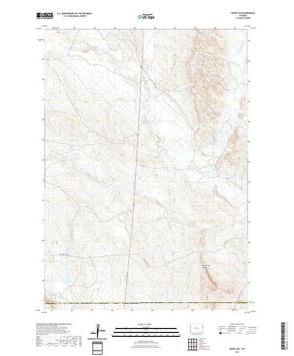
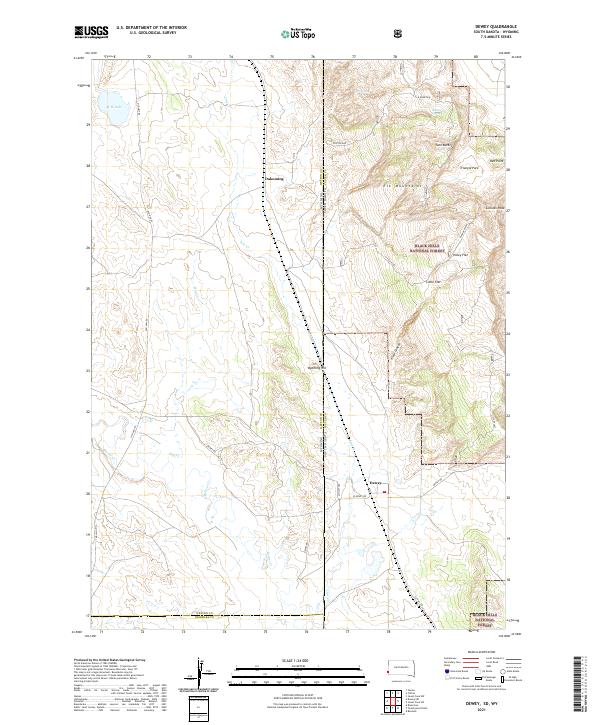 2021 Dewey2021 Print · USGSCuster County ranch lands meet the Black Hills high country in the early 2020s. Genealogists and historians can trace the border-straddling settlements of Dewey and Dakoming or locate family landmarks near Carr Spring and Holey Flat.
 - 2021 Map of Skull Creek, 2021 Print
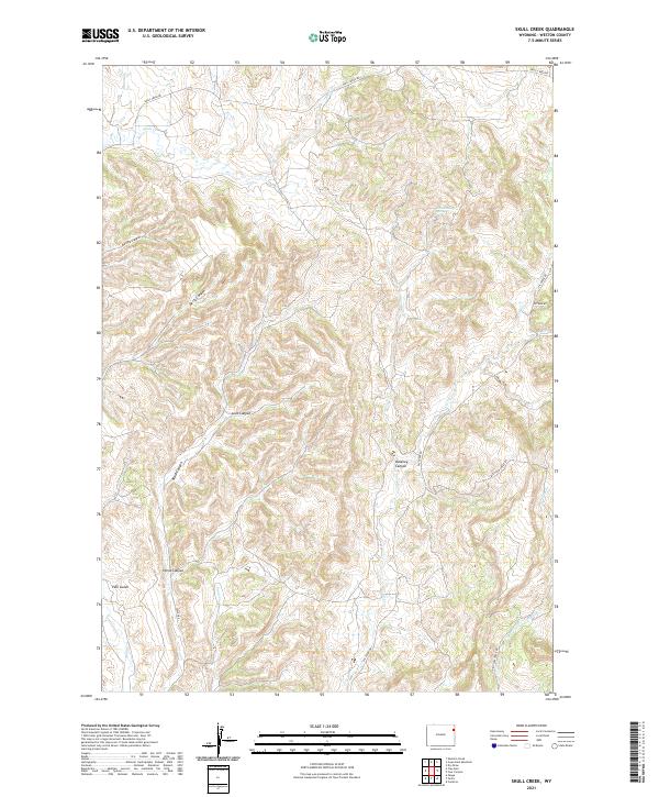 2021 Skull Creek2021 Print · USGSEastern Wyoming ranchlands and high canyon country are documented here in 2021. You can trace the rugged drainages of Skull Creek Canyon and locate isolated landmarks like Grand Stump Spring and Pine Gulch.
 - 2021 Map of Parmlee Canyon, 2021 Print
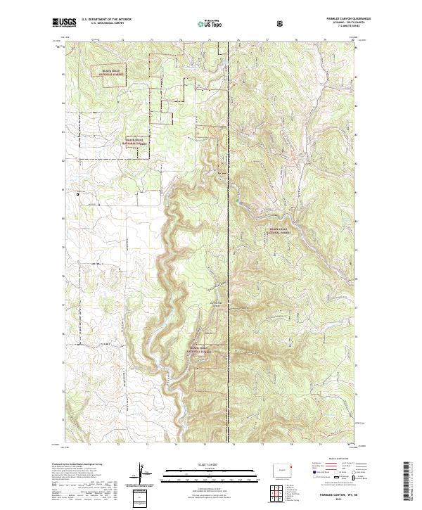 2021 Parmlee Canyon2021 Print · USGSThe interstate border of Wyoming and South Dakota comes alive in this contemporary survey of the Black Hills National Forest. Genealogists and hikers can locate Boyd Cem or trace numerous water sources like Austin Spring and Slicker Dick Spring.
 - 2021 Map of Sheldon Creek, 2021 Print
 2021 Sheldon Creek2021 Print · USGSCrook County and the surrounding grasslands are captured here in the early twenty-first century. Researchers can locate Greenwood Cem and trace livestock water sources like Jeff Davis Reservoir and Inyan Kara Cr.
 - 2021 Map of Whitetail Creek NE, 2021 Print
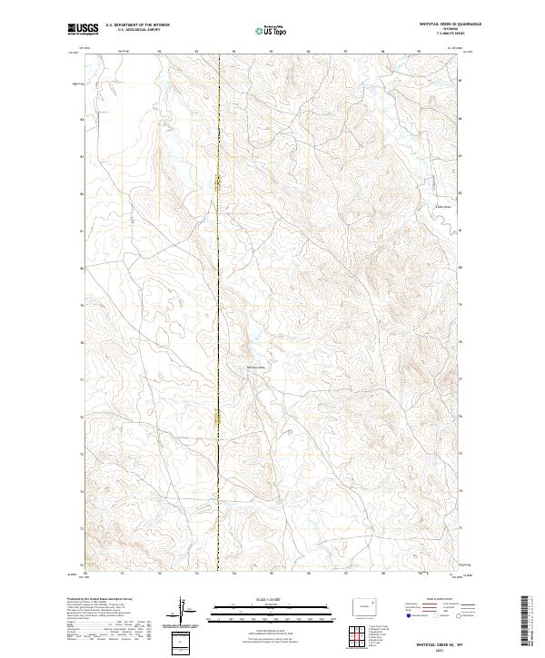
 2021 Whitetail Creek NE2021 Print · USGSCrook County ranching country is detailed here in the early 2020s, showcasing the intersection of three Wyoming counties. Researchers can trace rural access roads like Shipwheel Rd and follow water sources such as Buzzer Reservoir and Coyote Cr.
 - 2021 Map of Clay Spur, 2021 Print
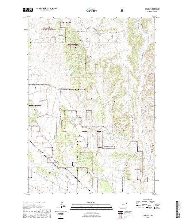 2021 Clay Spur2021 Print · USGSThe high plains of Weston County are captured here in the early twenty-first century, showing the intersection of ranching lands and public territory. Researchers can trace the layout of the Clay Spur settlement and remote water features like Kellog Reservoir and E Iron Cr.
 - 2021 Map of Spyglass Hill, 2021 Print
 2021 Spyglass Hill2021 Print · USGSThe border of Crook and Weston counties comes alive in this 2021 survey of the Wyoming high plains. Researchers can trace the rugged drainage patterns around Spy Glass Hill and follow the paths of Warbonnet Rd and Buffalo Creek Rd.
 - 2021 Map of Four Corners, 2021 Print
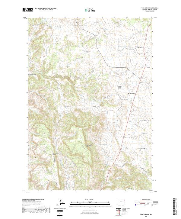 2021 Four Corners2021 Print · USGSWeston County at the start of the 2020s shows a landscape of high prairies and deep canyons shaped by centuries of ranching and natural drainage. Researchers can locate family landmarks like Saint Albert's Catholic Cem and trace the terrain from Sweetwater Mtn to Horsethief Canyon.
 - 2021 Map of Dry Draw, 2021 Print
 2021 Dry Draw2021 Print · USGSThe border of Crook and Weston counties comes alive in this modern survey of the Wyoming timberlands. Researchers can trace the winding paths of Soldier Cr and Cold Springs Cr or locate the Green Mountain Cem tucked away in the hills.
 - 2021 Map of Whitetail Creek SE, 2021 Print
 2021 Whitetail Creek SE2021 Print · USGSThe border of Weston and Campbell counties comes alive in the 2020s, showing a landscape shaped by seasonal drainages. Researchers can trace the path of Four Horse Cr and locate landforms like Mexican Draw and Cedar Draw along the remote O-R Rd.
 - 2021 Map of Buckhorn, 2021 Print
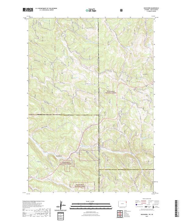 2021 Buckhorn2021 Print · USGSThe Wyoming and South Dakota borderlands come alive in this modern survey of the high-elevation Black Hills. Researchers can trace forest access routes and water sources like Buckhorn, O'Neil Pass, and the seasonal paths of Snow-3 Trl.
 - 2021 Map of Raven, 2021 Print
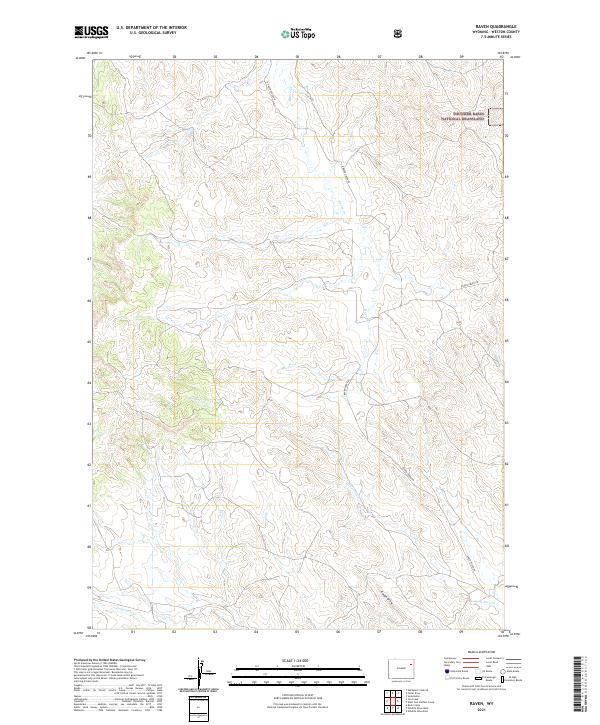 2021 Raven2021 Print · USGSWeston County’s open range is captured here in the early twenty-first century, showing the intersection of township sections and public land. Local researchers can trace the routes of Raven Creek Rd and locate the headwaters of Sage Cr and Lone Tree Cr.
 - 2021 Map of Morrisey NE, 2021 Print
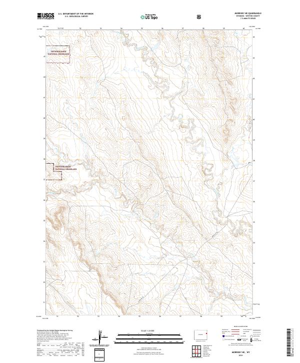 2021 Morrisey NE2021 Print · USGSWeston County at the start of the 2020s shows a landscape of expansive public rangelands and intricate seasonal drainages. Researchers can trace the path of Morrissey Rd as it winds through Thunder Basin National Grassland and crosses Beaver Cr.
 - 2021 Map of Osage, 2021 Print
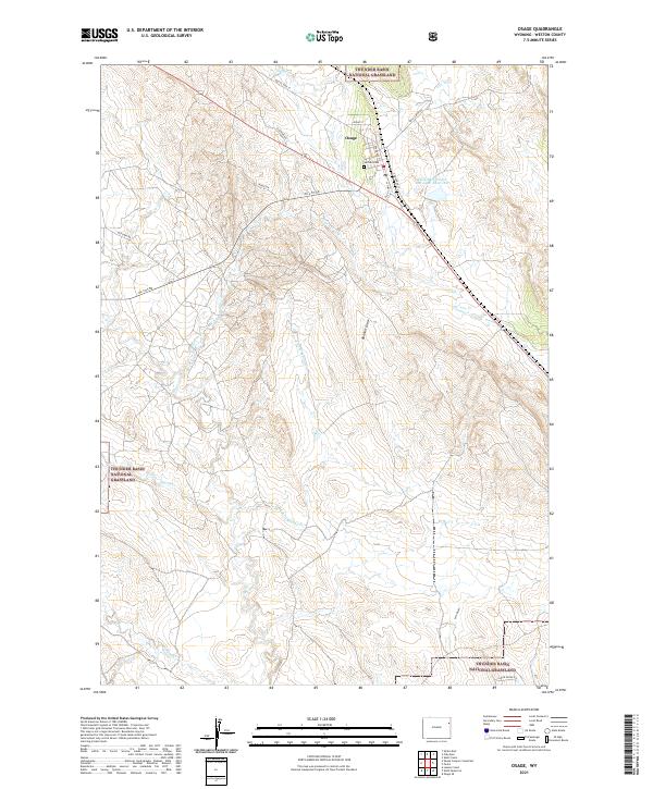 2021 Osage2021 Print · USGSOsage and the high plains of Weston County are documented here in the early twenty-first century as the landscape balances energy infrastructure and ranching. Researchers can locate Garhart Cem, the Black Hills Power and Light Reservoir, and the drainage of Beaver Cr.
 - 2021 Map of Lassen Creek, 2021 Print
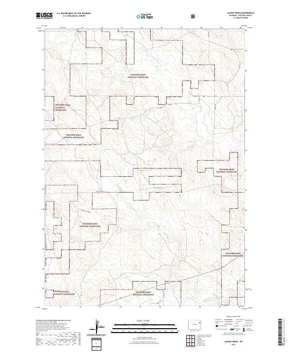 2021 Lassen Creek2021 Print · USGSThe high plains of Weston County are captured here in the early twenty-first century, showcasing the expansive territory of the Thunder Basin National Grassland. Genealogists and land researchers can trace the remote drainage networks of Lassen Cr and S Beaver Cr alongside established routes like Mush Creek Rd.
 - 2021 Map of Osage SE, 2021 Print
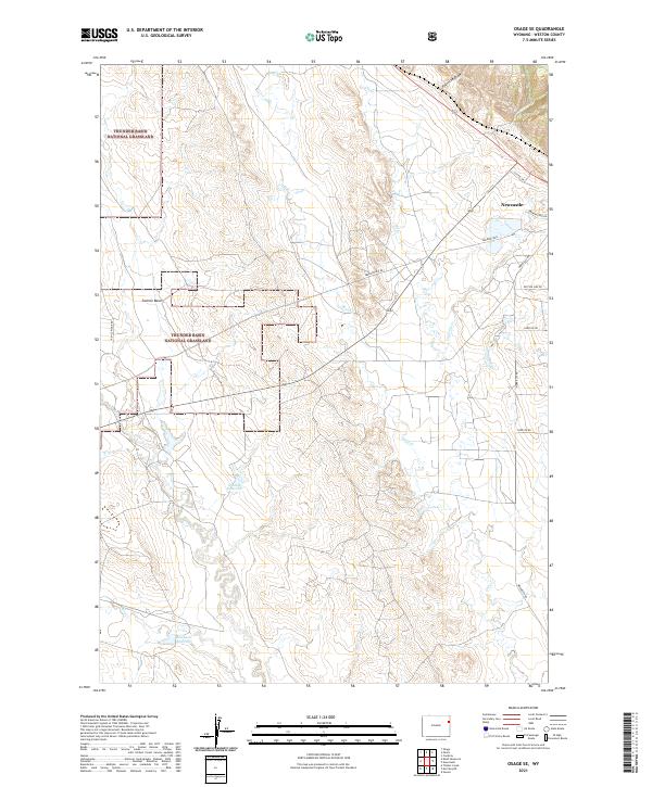 2021 Osage SE2021 Print · USGSWeston County's high plains are captured here in the early twenty-first century, showcasing the open range of the Thunder Basin National Grassland. Genealogists and land researchers can trace family-named routes like Eberspecher Rd and water features like Shostak Reservoir.
 - 2021 Map of The Nose West, 2021 Print
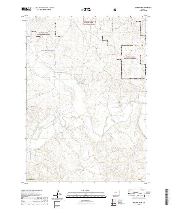 2021 The Nose West2021 Print · USGSThe High Plains of Weston and Niobrara Counties are captured here in the early twenty-first century. This survey allows researchers to trace the drainage basins of the Cheyenne River and Black Thunder Cr alongside landmarks like The Nose and Graham Draw.
 - 2021 Map of Darlington Draw East, 2021 Print
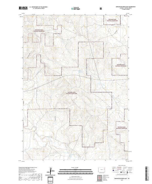 2021 Darlington Draw East2021 Print · USGSWeston County’s open plains are captured here in the early twenty-first century, showcasing the expansive territory of the Thunder Basin National Grassland. Researchers can trace the essential water sources of this high-desert region along Wildcat Creek and the Field 9-207-5 Reservoir.
 - 2021 Map of Darlington Draw West, 2021 Print
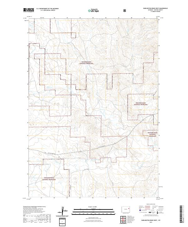 2021 Darlington Draw West2021 Print · USGSWeston County's high plains are shown in detail during the early 2020s, highlighting the vast reaches of the Thunder Basin National Grassland. Researchers can trace the winding paths of Black Thunder Cr and Darlington Draw alongside rural routes like Little Thunder Rd.
 - 2021 Map of Dewey SW, 2021 Print
 2021 Dewey SW2021 Print · USGSThe high plains of eastern Wyoming are captured here in the early twenty-first century as they span the Weston and Niobrara county line. Trace the remote road network along Cheyenne River Road and follow drainages like Robbers Roost Creek and Rattlesnake Ridge.
 - 2021 Map of Newcastle, 2021 Print
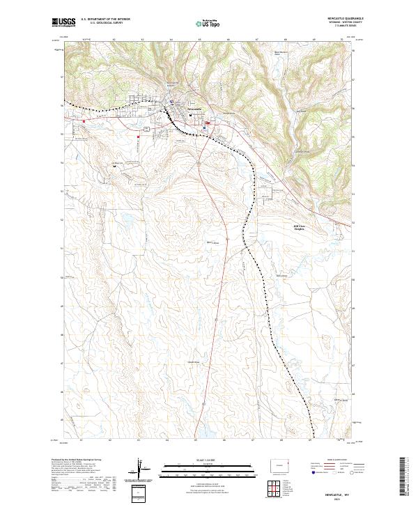 2021 Newcastle2021 Print · USGSNewcastle and the Weston County plains are captured here in the early twenty-first century as the community balances its civic roots and mining heritage. Genealogists can locate Greenwood Cem, while historians can trace the area's geography from the Weston County Courthouse to the Coal Mine at the edge of the draws.
 - 2021 Map of Dupont Creek, 2021 Print
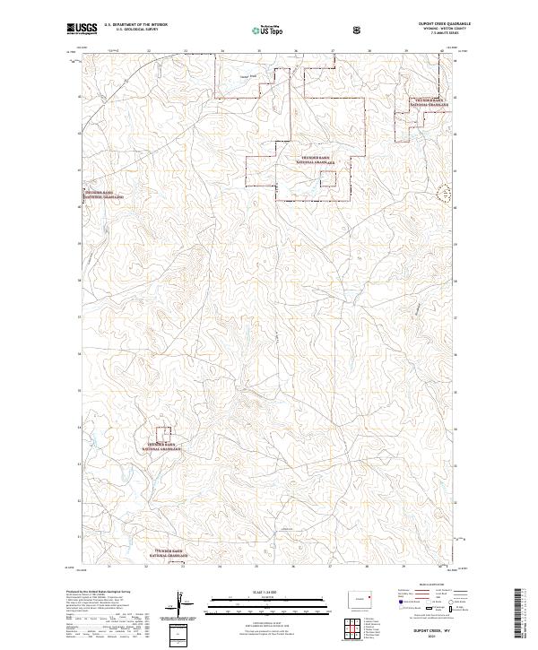 2021 Dupont Creek2021 Print · USGSWeston County ranching country is mapped here in the early twenty-first century, showing the vast open spaces of the northeastern Wyoming plains. Landowners and historians can trace seasonal watercourses like Dupont Cr and travel routes like Grieves Rd.
 - 2021 Map of Poddy Creek, 2021 Print
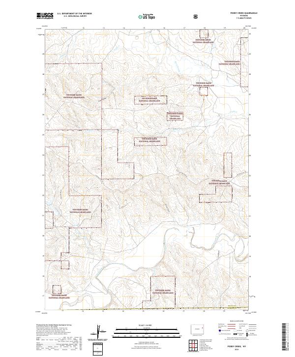 2021 Poddy Creek2021 Print · USGSEastern Wyoming ranching country is documented here in the early twenty-first century as the high plains meet the Cheyenne River. Local historians can trace the paths of Dull Center Rd and seasonal watercourses like Horse Cr and Black Thunder Cr.
 - 2021 Map of Wagonhound Creek NE, 2021 Print
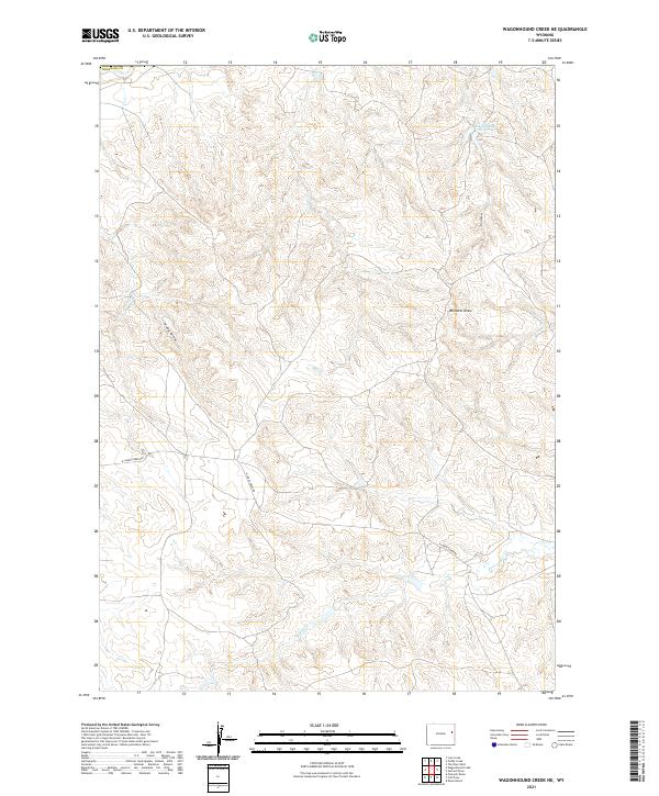 2021 Wagonhound Creek NE2021 Print · USGSNiobrara County at the start of the 2020s remains a landscape of sprawling ranchland and seasonal watercourses. Local researchers can trace the routes of N Lance Creek Rd and identify landmarks like Fred Number 1 Reservoir and Windmill Draw.
Showing maps 1-25 of 57
Top cities of Weston County
Frequently asked questions
- What are the different types of historical maps available for Weston County?
- What is the oldest map of Weston County?
- Where can I purchase historical maps of Weston County for my home or office?
- Where can I download high-res historical maps of Weston County?
- Are there historical topographic maps available for Weston County?
- Is there historical aerial imagery available for Weston County?
- Where are historical maps of Weston County sourced from?