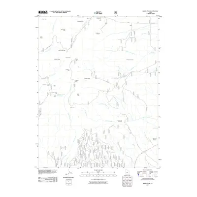
2011 Map of Abajo Peak
USGS Topo · Published 2011About this map
Abajo Peak towers over this section of San Juan County, anchoring a landscape defined by high-elevation landmarks and early 21st-century recreation. The terrain is marked by significant extractive history, notably the Gold Queen Mine near Gold Queen Basin and the Dream Mine situated by Cooley Gulch. These sites sit alongside more modern land uses, including the Blue Mountain Ski Area and Dalton Spring Campground.
Find a feature on this map
43 named features on this map. Tap any name to fly to it.
Don’t see what you’re looking for? This feature index may not catch every label — zoom into the map to look around manually.
Map Details
Editions of this 2011 Abajo Peak Map
This is the sole edition of this map. No revisions or reprints were ever made.
Other maps of this area

1886 · Abajo
USGS Topo · 1:250,000

1892 · Abajo
USGS Topo · 1:250,000

1893 · Abajo
USGS Topo · 1:250,000

1935 · Elk Ridge
USGS Topo · 1:96,000

1940 · Elk Ridge
USGS Topo · 1:125,000

1954 · Elk Ridge 1 NE
USGS Topo · 1:24,000

1954 · Elk Ridge 1 SE
USGS Topo · 1:24,000
1954 · Mt Linnaeus
USGS Topo · 1:62,500

1955 · Verdure 2 SE
USGS Topo · 1:24,000

1955 · Verdure 3 NE
USGS Topo · 1:24,000