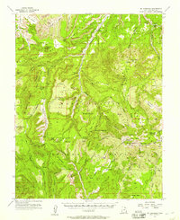
1954 Map of Mt Linnaeus
USGS Topo · Published 1957About this map
Chippean National Forest dominates this mid-century survey of the high desert and canyon country of San Juan County. Remote outposts such as Wilson Ranch, Kelly Ranch, and Bayles Ranch are tucked into the drainages of Cottonwood Creek and Shay Canyon, illustrating the survival of cattle and sheep operations in a terrain defined by massive uplifts like Shay Mtn and Mt Linnaeus. The presence of Cliff Dwellings and landmarks like Skull and Crossbones and The Wilderness suggests a landscape where ancient habitation and geographic isolation intersect.
Find a feature on this map
76 named features on this map. Tap any name to fly to it.
Don’t see what you’re looking for? This feature index may not catch every label — zoom into the map to look around manually.
Map Details
Editions of this 1954 Mt Linnaeus Map
4 editions found
Other maps of this area

1885 · La Sal
USGS Topo · 1:250,000

1886 · Abajo
USGS Topo · 1:250,000

1892 · Abajo
USGS Topo · 1:250,000

1893 · Abajo
USGS Topo · 1:250,000

1935 · Elk Ridge
USGS Topo · 1:96,000

1940 · Elk Ridge
USGS Topo · 1:125,000

1953 · The Needles
USGS Topo · 1:62,500

1954 · Elk Ridge 4 NW
USGS Topo · 1:24,000

1954 · Elk Ridge 1 SW
USGS Topo · 1:24,000

1954 · Elk Ridge 2 SE
USGS Topo · 1:24,000