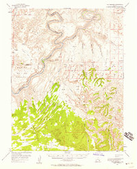
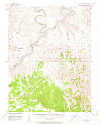
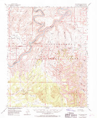
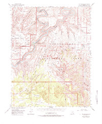
1953 Map of The Needles
USGS Topo · Published 1958About this map
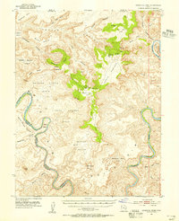
The Maze and the winding course of the Green River define this 1953 survey, documenting the complex topography before this section of the Colorado Plateau became a national park. The map centers on the confluence where the Green meets the Colorado River, leading into the turbulent waters of Cataract Canyon. This era of documentation shows the landscape as it was known to ranchers and early explorers, with family-named landmarks like Pappys Pasture and Bobbys Hole appearing alongside geological icons such as Candlestick Spire and Standing Rock.
Find a feature on this map
64 named features on this map. Tap any name to fly to it.
Don’t see what you’re looking for? This feature index may not catch every label — zoom into the map to look around manually.
Map Details
Editions of this 1953 The Needles Map
4 editions found
Other maps of this area

1885 · San Rafael
USGS Topo · 1:250,000

1885 · La Sal
USGS Topo · 1:250,000

1886 · Henry Mountains
USGS Topo · 1:250,000

1886 · Abajo
USGS Topo · 1:250,000

1892 · Abajo
USGS Topo · 1:250,000

1892 · Henry Mountains
USGS Topo · 1:250,000

1893 · Abajo
USGS Topo · 1:250,000

1935 · Elk Ridge
USGS Topo · 1:96,000

1940 · Elk Ridge
USGS Topo · 1:125,000
1951 · Upheaval Dome
USGS Topo · 1:62,500