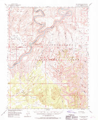
1953 Map of The Needles
USGS Topo · Published 1970About this map
Green River and the Colorado River meet at the iconic Confluence Overlook, carving a path through the sandstone high desert of Canyonlands National Park. This 1950s era survey, updated just after the park's establishment, reveals the intricate drainage systems of Stillwater Canyon and Cataract Canyon before the modern influx of tourism. Notable landmarks for navigators and backcountry travelers include The Doll House and Spanish Bottom, alongside the spire-filled labyrinth of The Needles.
Find a feature on this map
73 named features on this map. Tap any name to fly to it.
Don’t see what you’re looking for? This feature index may not catch every label — zoom into the map to look around manually.
Map Details
Editions of this 1953 The Needles Map
4 editions found

Other maps of this area

1885 · San Rafael
USGS Topo · 1:250,000

1885 · La Sal
USGS Topo · 1:250,000

1886 · Henry Mountains
USGS Topo · 1:250,000

1886 · Abajo
USGS Topo · 1:250,000

1892 · Abajo
USGS Topo · 1:250,000

1892 · Henry Mountains
USGS Topo · 1:250,000

1893 · Abajo
USGS Topo · 1:250,000

1935 · Elk Ridge
USGS Topo · 1:96,000

1940 · Elk Ridge
USGS Topo · 1:125,000

1951 · Upheaval Dome
USGS Topo · 1:62,500