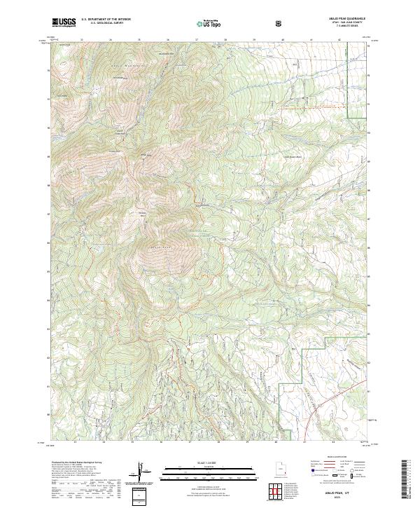
2023 Map of Abajo Peak
USGS Topo · Published 2023About this map
Abajo Peak rises as the central focal point of this high-altitude landscape within the Manti-La Sal National Forest. The survey reveals a complex network of ridgelines and summits, including Horsehead Peak, North Peak, and South Peak, which define the drainage basins of the Abajo Mountains. Water management and recreational infrastructure are evident through the Camp Jackson Reservoir and Dalton Springs, while the lower elevations show the transition to deep drainage features like Bulldog Canyon and Long Canyon.
Find a feature on this map
51 named features on this map. Tap any name to fly to it.
Don’t see what you’re looking for? This feature index may not catch every label — zoom into the map to look around manually.
Map Details
Editions of this 2023 Abajo Peak Map
This is the sole edition of this map. No revisions or reprints were ever made.
Other maps of this area

1886 · Abajo
USGS Topo · 1:250,000

1892 · Abajo
USGS Topo · 1:250,000

1893 · Abajo
USGS Topo · 1:250,000

1935 · Elk Ridge
USGS Topo · 1:96,000

1940 · Elk Ridge
USGS Topo · 1:125,000

1954 · Elk Ridge 1 NE
USGS Topo · 1:24,000

1954 · Elk Ridge 1 SE
USGS Topo · 1:24,000
1954 · Mt Linnaeus
USGS Topo · 1:62,500

1955 · Verdure 2 SE
USGS Topo · 1:24,000

1955 · Verdure 3 NE
USGS Topo · 1:24,000