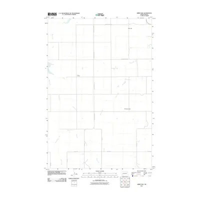
2011 Map of Abbey Hill
USGS Topo · Published 2011About this map
Alden Cemetery sits along the western edge of this agricultural landscape in Hettinger County, marking a localized point of family history within the expansive prairie. The terrain is defined by distinct elevations such as Abbey Hill in the northeast and Anderson Butte further south, providing prominent landmarks for a region carved by seasonal waterways. The drainage pattern is established by the meandering paths of Indian Creek, Dayton Creek, and Spring Creek, which intersect a strictly organized section-line road network. This grid of rural thoroughfares, including Hettinger Regent Rd and various numbered routes like 19th Ave NE and 5th St NE, reflects the enduring layout of North Dakota's homestead-era land divisions into the early twenty-first century.
Find a feature on this map
14 named features on this map. Tap any name to fly to it.
Don’t see what you’re looking for? This feature index may not catch every label — zoom into the map to look around manually.
Map Details
Editions of this 2011 Abbey Hill Map
This is the sole edition of this map. No revisions or reprints were ever made.
Other maps of this area

1953 · Dickinson
USGS Topo · 1:250,000

1957 · Dickinson
USGS Topo · 1:250,000

1966 · Mott NW
USGS Topo · 1:24,000

1966 · Regent
USGS Topo · 1:24,000

1966 · Mott SW
USGS Topo · 1:24,000

1973 · Liens Dams
USGS Topo · 1:24,000

1973 · Havelock
USGS Topo · 1:24,000

1973 · Abbey Hill
USGS Topo · 1:24,000

1974 · Pearl Butte NW
USGS Topo · 1:24,000

1980 · Mott
USGS Topo · 1:100,000