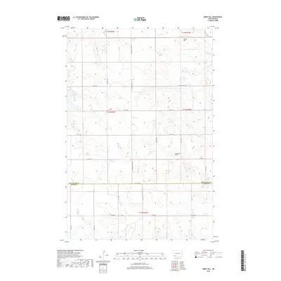
2018 Map of Abbey Hill
USGS Topo · Published 2018About this map
Abbey Hill and Anderson Butte rise as prominent landmarks above the sectioned prairie of the North Dakota badlands border. This 2018 survey documents a remote landscape defined by its township-and-range grid, where the Hettinger Co Adams Co line divides the southern drainage of Spring Cr from the northern reaches of Indian Cr and Dayton Cr. The presence of the Alden Cem along 75th St SW provides a vital point of reference for genealogists tracing early homesteaders in this sparsely populated region. The map reflects the enduring rural character of the Great Plains, where long thoroughfares like Hettinger Regent Rd connect isolated ranching tracts across the rolling divide between the Chilton Cr and Indian Creek watersheds.
Find a feature on this map
29 named features on this map. Tap any name to fly to it.
Don’t see what you’re looking for? This feature index may not catch every label — zoom into the map to look around manually.
Map Details
Editions of this 2018 Abbey Hill Map
This is the sole edition of this map. No revisions or reprints were ever made.
Other maps of this area

1953 · Dickinson
USGS Topo · 1:250,000

1957 · Dickinson
USGS Topo · 1:250,000

1966 · Mott NW
USGS Topo · 1:24,000

1966 · Regent
USGS Topo · 1:24,000

1966 · Mott SW
USGS Topo · 1:24,000

1973 · Liens Dams
USGS Topo · 1:24,000

1973 · Havelock
USGS Topo · 1:24,000

1973 · Abbey Hill
USGS Topo · 1:24,000

1974 · Pearl Butte NW
USGS Topo · 1:24,000

1980 · Mott
USGS Topo · 1:100,000