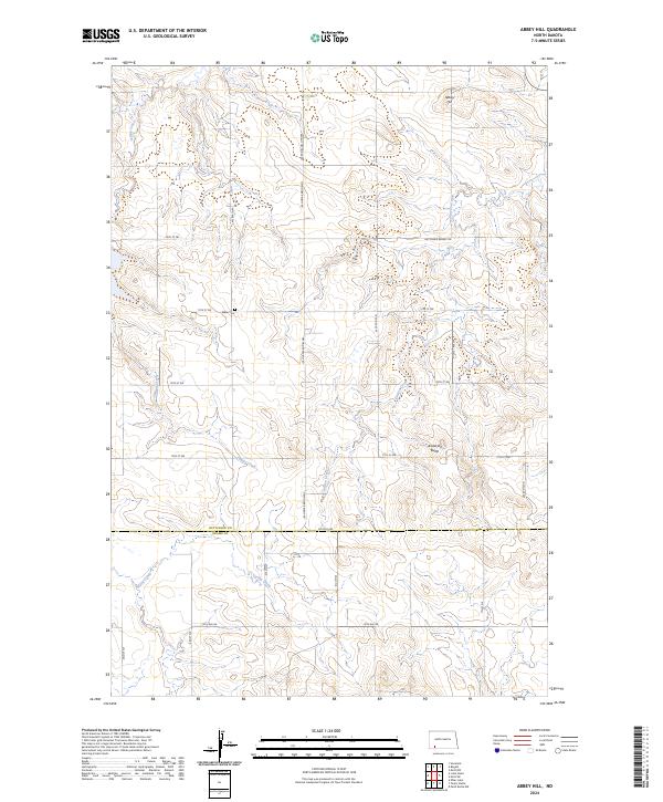
2024 Map of Abbey Hill
USGS Topo · Published 2024About this map
Abbey Hill rises as a prominent landmark in this high plains landscape on the border of Hettinger and Adams Counties. This modern survey illustrates a classic North Dakota township and range grid, where section lines are defined by long-distance thoroughfares such as Regent Hettinger Rd and Hettinger Regent Rd. The region’s drainage is defined by the winding paths of Indian Creek and Dayton Creek, which carve subtle valleys through the open terrain. For those investigating the settlement history of the area, Alden Cem sits isolated among the fields north of 75th St SW, serving as a quiet marker of the community's early families. To the south, Anderson Butte provides additional topographical variety in a landscape primarily dedicated to agriculture and livestock, where Spring Creek and S Spring Creek provide essential water sources.
Find a feature on this map
30 named features on this map. Tap any name to fly to it.
Don’t see what you’re looking for? This feature index may not catch every label — zoom into the map to look around manually.
Map Details
Editions of this 2024 Abbey Hill Map
This is the sole edition of this map. No revisions or reprints were ever made.
Other maps of this area

1953 · Dickinson
USGS Topo · 1:250,000

1957 · Dickinson
USGS Topo · 1:250,000

1966 · Mott NW
USGS Topo · 1:24,000

1966 · Regent
USGS Topo · 1:24,000

1966 · Mott SW
USGS Topo · 1:24,000

1973 · Liens Dams
USGS Topo · 1:24,000

1973 · Havelock
USGS Topo · 1:24,000

1973 · Abbey Hill
USGS Topo · 1:24,000

1974 · Pearl Butte NW
USGS Topo · 1:24,000

1980 · Mott
USGS Topo · 1:100,000