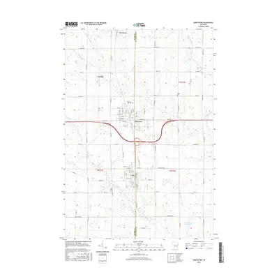
2015 Map of Abbotsford
USGS Topo · Published 2015About this map
Abbotsford and its neighboring communities of Colby and Dorchester sit at the intersection of agricultural heritage and modern transit corridors along the border of Clark and Marathon counties. The landscape is defined by its small-town grid systems and the vital waterways that drain the central Wisconsin terrain, including the North Fork Popple River and the Big Eau Pleine River. Family historians can locate several local burial grounds such as the Abbotsford Public Cemetery and Holton Cemetery, while the presence of Jones Airport and the Winding Creek Rearing Pond highlight the local infrastructure and conservation efforts of the area. The map illustrates how historic thoroughfares like Old Highway 29 and numerous county roads like County Road N continue to connect these dairy-region settlements.
Find a feature on this map
90 named features on this map. Tap any name to fly to it.
Don’t see what you’re looking for? This feature index may not catch every label — zoom into the map to look around manually.
Map Details
Editions of this 2015 Abbotsford Map
This is the sole edition of this map. No revisions or reprints were ever made.
Other maps of this area

1902 · Marathon
USGS Topo · 1:125,000

1951 · Athens
USGS Topo · 1:48,000

1951 · Medford
USGS Topo · 1:48,000

1953 · Abbotsford
USGS Topo · 1:48,000

1953 · Stratford
USGS Topo · 1:48,000

1953 · Eau Claire
USGS Topo · 1:250,000

1953 · Rice Lake
USGS Topo · 1:250,000

1958 · Eau Claire
USGS Topo · 1:250,000

1959 · Rice Lake
USGS Topo · 1:250,000

1963 · Stratford
USGS Topo · 1:62,500