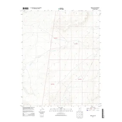
2013 Map of Abbott NW
USGS Topo · Published 2013About this map
Rio del Plano winds through the high plains of Colfax County, cutting a distinct drainage pattern across this arid landscape in the early 21st century. The terrain is defined by its intermittent watercourses, including the Alkali Arroyo and Ladd Arroyo, which mark the seasonal flow of water toward larger basins. This region of New Mexico is characterized by a precise grid of land management, shown here through the Public Land Survey System township and range boundaries like t26n r23e and t25n r24e. Infrastructure is sparse in this open country, with Co Road C-34 providing one of the few established access routes through the eastern sections of the quadrangle. The map reveals a high-altitude environment where the elevation exceeds 6,000 feet, emphasizing the significance of features like Rondeau Cr in a territory where geography and hydrology dictate land use.
Find a feature on this map
9 named features on this map. Tap any name to fly to it.
Don’t see what you’re looking for? This feature index may not catch every label — zoom into the map to look around manually.
Map Details
Editions of this 2013 Abbott NW Map
This is the sole edition of this map. No revisions or reprints were ever made.
Other maps of this area

1915 · Koehler
USGS Topo · 1:62,500

1917 · Koehler
USGS Topo · 1:62,500

1954 · Raton
USGS Topo · 1:250,000

1958 · Raton
USGS Topo · 1:250,000

1965 · Sauble Circle Dot Ranch
USGS Topo · 1:24,000

1965 · Abbott NW
USGS Topo · 1:24,000

1965 · French
USGS Topo · 1:24,000

1965 · Taylor Springs
USGS Topo · 1:24,000

1965 · Abbott
USGS Topo · 1:24,000

1965 · Springer
USGS Topo · 1:24,000