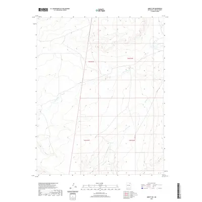
2020 Map of Abbott NW
USGS Topo · Published 2020About this map
Rio del Plano meanders through this high-altitude section of Colfax County, marking a landscape defined by intermittent watercourses and wide-reaching township boundaries. The map details a predominantly rural expanse where the natural drainage patterns of Alkali Arroyo and Rondeau Cr shape the topography. Modern infrastructure is sparse, represented primarily by Co RD C-34, which provides the main north-south transit across the eastern sections. This survey illustrates the persistent ranching and range land layout of northern New Mexico, clearly delineating the Public Land Survey System grids including t26n r23e, t26n r24e, t25n r23e, and t25n r24e. The interaction between these surveyed lines and the natural curves of the arroyos offers a clear look at how property and management boundaries have been superimposed on the arid geography of the region.
Find a feature on this map
8 named features on this map. Tap any name to fly to it.
Don’t see what you’re looking for? This feature index may not catch every label — zoom into the map to look around manually.
Map Details
Editions of this 2020 Abbott NW Map
This is the sole edition of this map. No revisions or reprints were ever made.
Other maps of this area

1915 · Koehler
USGS Topo · 1:62,500

1917 · Koehler
USGS Topo · 1:62,500

1954 · Raton
USGS Topo · 1:250,000

1958 · Raton
USGS Topo · 1:250,000

1965 · Sauble Circle Dot Ranch
USGS Topo · 1:24,000

1965 · Abbott NW
USGS Topo · 1:24,000

1965 · French
USGS Topo · 1:24,000

1965 · Taylor Springs
USGS Topo · 1:24,000

1965 · Abbott
USGS Topo · 1:24,000

1965 · Springer
USGS Topo · 1:24,000