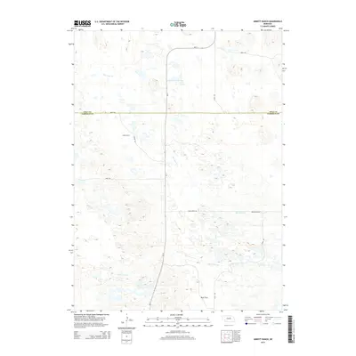
2014 Map of Abbott Ranch
USGS Topo · Published 2014About this map
Abbott Ranch and the surrounding ranchlands of the Nebraska Sandhills are captured in this 2014 survey along the boundary of Holt and Garfield counties. The landscape is defined by the drainage of Big Cedar Cr and Little Cedar Cr, which wind through a complex topography of sand dunes and meadows typical of this region. The map documents the rural infrastructure of the early 21st century, centered on local routes such as Carson Rd and Cedar River Rd. South of the main ranch, the terrain levels out into Beat Flats, showing the transition from shifting dune formations to more stable plateau areas. State Highway Ne-11 serves as the primary north-south artery through this sparsely settled cattle country, providing a clear record of land use and transport patterns in the modern era.
Find a feature on this map
13 named features on this map. Tap any name to fly to it.
Don’t see what you’re looking for? This feature index may not catch every label — zoom into the map to look around manually.
Map Details
Editions of this 2014 Abbott Ranch Map
This is the sole edition of this map. No revisions or reprints were ever made.
Other maps of this area

1952 · Burwell NE
USGS Topo · 1:24,000

1952 · Burwell NW
USGS Topo · 1:24,000

1954 · Gables NW
USGS Topo · 1:24,000

1955 · Broken Bow
USGS Topo · 1:250,000

1955 · O'Neill
USGS Topo · 1:250,000

1956 · Broken Bow
USGS Topo · 1:250,000

1959 · O'Neill
USGS Topo · 1:250,000

1969 · O'Neill
USGS Topo · 1:250,000
1981 · Abbott Ranch
USGS Topo · 1:24,000

1981 · Swan Lake
USGS Topo · 1:24,000