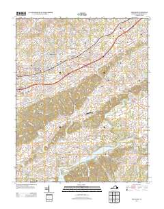
2013 Map of Abingdon
USGS Topo · Published 2013About this map
The historic town of Abingdon serves as the focal point for this survey of southwest Virginia, where the landscape transitions from established neighborhoods like Morningside Hills and Scott Addition into a network of fertile valleys and industrial remnants. The legacy of water-powered industry is evident in the alignment of several named facilities including Stone Mill, Vance Mill, and Parks Mill, each situated along the area's vital waterways. To the south, the terrain descends toward the extensive shoreline of South Holston Lake, which is fed by the S Fork Holston River and Middle Fork Holston River. This area is characterized by prominent ridges such as the Great Knobs and River Knobs, which dictate the placement of rural settlements like Watauga and Alvarado. Notable landmarks such as Latture Field in the town center and the Old South Aerodrome to the southeast highlight the mix of modern recreation and localized aviation within this traditional Appalachian corridor.
Find a feature on this map
148 named features on this map. Tap any name to fly to it.
Don’t see what you’re looking for? This feature index may not catch every label — zoom into the map to look around manually.
Map Details
Editions of this 2013 Abingdon Map
This is the sole edition of this map. No revisions or reprints were ever made.
Other maps of this area

1891 · Abingdon
USGS Topo · 1:125,000

1894 · Abingdon
USGS Topo · 1:125,000

1897 · Bristol
USGS Topo · 1:125,000

1902 · Bristol
USGS Topo · 1:125,000

1909 · Abingdon
USGS Topo · 1:96,000

1911 · Abingdon
USGS Topo · 1:125,000

1918 · Carterton
USGS Topo · 1:62,500

1934 · Holston Valley
USGS Topo · 1:24,000

1934 · Brumley
USGS Topo · 1:24,000

1934 · Wyndale
USGS Topo · 1:24,000