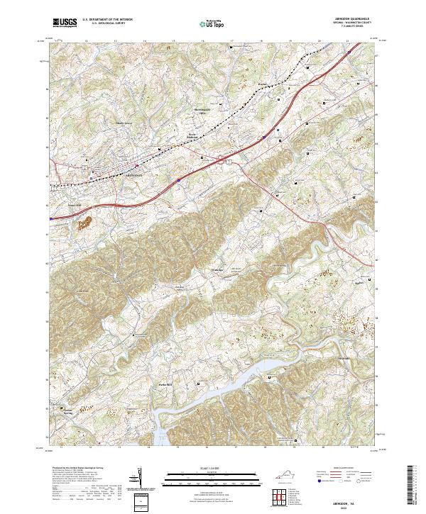
2022 Map of Abingdon
USGS Topo · Published 2022About this map
Abingdon stands as the central hub in this survey of southwestern Virginia, anchored by the Washington County Courthouse and numerous historic burial grounds like Sinking Spring Cem. The landscape transitions from the urbanized core of Scott Addition and Morningside Hills to the complex ridges of the Great Knobs and River Knobs. Transportation history is prominently visible via the Virginia Creeper Trl, which winds through the southern terrain toward the settlement of Alvarado and the waters of South Holston Lake.
Find a feature on this map
76 named features on this map. Tap any name to fly to it.
Don’t see what you’re looking for? This feature index may not catch every label — zoom into the map to look around manually.
Map Details
Editions of this 2022 Abingdon Map
This is the sole edition of this map. No revisions or reprints were ever made.
Other maps of this area

1891 · Abingdon
USGS Topo · 1:125,000

1894 · Abingdon
USGS Topo · 1:125,000

1897 · Bristol
USGS Topo · 1:125,000

1902 · Bristol
USGS Topo · 1:125,000

1909 · Abingdon
USGS Topo · 1:96,000

1911 · Abingdon
USGS Topo · 1:125,000

1918 · Carterton
USGS Topo · 1:62,500

1934 · Holston Valley
USGS Topo · 1:24,000

1934 · Brumley
USGS Topo · 1:24,000

1934 · Wyndale
USGS Topo · 1:24,000