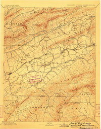
1909 Map of Abingdon
USGS Topo · Published 1909About this map
Abingdon serves as the focal point for this Southwest Virginia region at the start of the twentieth century, where the Norfolk and Western R. R. connects timber and agricultural valley towns. The landscape is defined by the high elevations of Mt. Rogers and White Top, falling away into river valleys powered by numerous water-driven enterprises such as De Busks Mill, Vance's Mill, and Mocks Mill. Educational and social hubs appear at Emory and Henry College and the mineral waters of Washington Springs. In the northern portion of the survey, the industrial importance of Saltville stands out alongside the rural trade center at Blackwells Store. This survey captures the complex topography of the Iron Mts. and Brushy Mt. before modern infrastructure altered the traditional paths between the mountain gaps.
Find a feature on this map
117 named features on this map. Tap any name to fly to it.
Don’t see what you’re looking for? This feature index may not catch every label — zoom into the map to look around manually.
Map Details
Editions of this 1909 Abingdon Map
2 editions found

Other maps of this area

1886 · Grundy
USGS Topo · 1:125,000

1887 · Pocahontas
USGS Topo · 1:125,000

1889 · Wytheville
USGS Topo · 1:125,000

1889 · Wilkesboro
USGS Topo · 1:125,000

1890 · Grundy
USGS Topo · 1:125,000

1891 · Tazewell
USGS Topo · 1:125,000

1891 · Pocahontas
USGS Topo · 1:125,000

1891 · Roan Mountain
USGS Topo · 1:125,000

1891 · Abingdon
USGS Topo · 1:125,000

1891 · Wilkesboro
USGS Topo · 1:125,000