
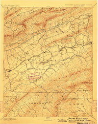
1909 Map of Abingdon
USGS Topo · Published 1909About this map
The town of Abingdon serves as the focal point for this early twentieth-century survey of Southwest Virginia, where the Norfolk and Western RR cuts a path through the valley between Clinch Mountain and Walker Mountain. This landscape is defined by its deep agricultural and early industrial roots, evidenced by the presence of a County Farm and a Quarry near Glade Spring. To the north and south, the terrain becomes increasingly steep as it approaches the Virginia-Tennessee and Virginia-North Carolina borders. Local history is recorded in the placement of rural landmarks like Greenfield Church and Bethel Church, alongside water-powered industry at Dinsmore Mill and Dove Mills. The Holston River and Beaver Creek wind through the southern portion of the quadrangle, illustrating the importance of natural drainage in the settlement patterns of Watkins and Wyndale.
Find a feature on this map
26 named features on this map. Tap any name to fly to it.
Don’t see what you’re looking for? This feature index may not catch every label — zoom into the map to look around manually.
Map Details
Editions of this 1909 Abingdon Map
2 editions found
Other maps of this area

1886 · Grundy
USGS Topo · 1:125,000

1887 · Pocahontas
USGS Topo · 1:125,000

1889 · Wytheville
USGS Topo · 1:125,000

1889 · Wilkesboro
USGS Topo · 1:125,000

1890 · Grundy
USGS Topo · 1:125,000

1891 · Tazewell
USGS Topo · 1:125,000

1891 · Pocahontas
USGS Topo · 1:125,000

1891 · Roan Mountain
USGS Topo · 1:125,000

1891 · Abingdon
USGS Topo · 1:125,000

1891 · Wilkesboro
USGS Topo · 1:125,000