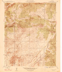
1947 Map of Academy
USGS Topo · Published 1947About this map
Academy serves as the focal point for this 1946 revised survey of the California foothills, situated near the intersection of Tollhouse Road and Little Dry Road. The landscape is defined by the prominent Table Mountain to the northwest and the drainages of Little Dry Creek and Dry Creek. This era of the Central Valley foothills shows a transition from traditional ranching properties like Blasingame Ranch and Shide Ranch to localized infrastructure including the McKenzie Fire Camp and the Sentinel Sch.
Find a feature on this map
19 named features on this map. Tap any name to fly to it.
Don’t see what you’re looking for? This feature index may not catch every label — zoom into the map to look around manually.
Map Details
Editions of this 1947 Academy Map
2 editions found
Other maps of this area

1904 · Kaiser
USGS Topo · 1:125,000

1912 · Mariposa
USGS Topo · 1:125,000

1916 · Sulphur Springs
USGS Topo · 1:24,000

1919 · Sulphur Springs
USGS Topo · 1:31,680

1920 · Orangedale School
USGS Topo · 1:24,000

1922 · Round Mountain
USGS Topo · 1:31,680

1922 · Trimmer
USGS Topo · 1:96,000

1922 · Friant
USGS Topo · 1:31,680

1923 · Academy
USGS Topo · 1:31,680

1923 · Orangedale School
USGS Topo · 1:31,680