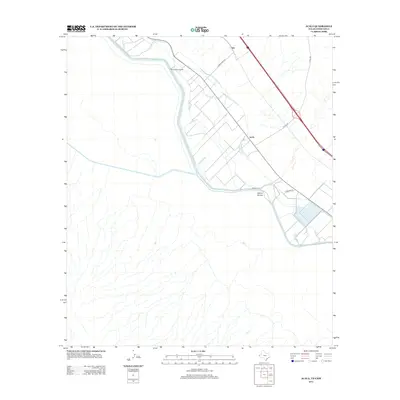
2013 Map of Acala
USGS Topo · Published 2013About this map
The settlement of Acala and its surrounding agricultural infrastructure dominate this borderland landscape. Engineered waterways including the Hudspeth Main Canal, Piedra Cooke Drain, and the Acala Lateral crisscross the valley, illustrating the complex irrigation network essential for farming in this arid environment near the Rio Grande. Further north, the smaller rail or road sidings at Iser and McCaskills Crossing provide evidence of historical transport hubs and access points for the rural community. The terrain is defined by the contrast between these managed water systems and natural drainage features like Alamo Arroyo, showing a landscape heavily modified for productivity during the early 21st century.
Find a feature on this map
16 named features on this map. Tap any name to fly to it.
Don’t see what you’re looking for? This feature index may not catch every label — zoom into the map to look around manually.
Map Details
Editions of this 2013 Acala Map
This is the sole edition of this map. No revisions or reprints were ever made.
Other maps of this area

1894 · Fort Hancock
USGS Topo · 1:125,000

1896 · Rio Grande
USGS Topo · 1:125,000

1941 · Tornillo
USGS Topo · 1:62,500

1943 · Fort Hancock
USGS Topo · 1:62,500
1943 · McNary
USGS Topo · 1:62,500
1945 · Tornillo
USGS Topo · 1:62,500

1953 · El Paso
USGS Topo · 1:250,000

1954 · Van Horn
USGS Topo · 1:250,000

1958 · Van Horn
USGS Topo · 1:250,000

1959 · El Paso
USGS Topo · 1:250,000