2022 Map of Acala
USGS Topo · Published 2022About this map
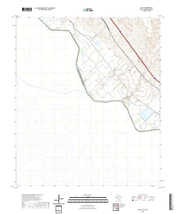
The Rio Grande forms a prominent international boundary here, separating the United States and Mexico. This desert landscape in Hudspeth County is defined by an intricate network of irrigation infrastructure designed to manage the river's flow through the arid valley. The settlement of Acala is the central hub of this agricultural zone, supported by the Hudspeth Main Canal and a series of secondary waterways including the Acala Lateral, Young Lateral, and Kelly Lateral. The dry drainage of the Alamo Arroyo cuts through the terrain, illustrating the contrast between the natural desert washes and the engineered Piedra Cooke Drain and Upper Drain systems. Local transit is marked by several named thoroughfares such as Alamo Lake Rd, Soto Rd, and Miller Spur, which connect the scattered farms and homesteads in this borderland corridor.
Find a feature on this map
18 named features on this map. Tap any name to fly to it.
Don’t see what you’re looking for? This feature index may not catch every label — zoom into the map to look around manually.
Map Details
Editions of this 2022 Acala Map
This is the sole edition of this map. No revisions or reprints were ever made.