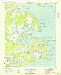
1948 Map of Achilles
USGS Topo · Published 1948About this map
Guinea Neck and the surrounding Chesapeake lowlands are intricately mapped in this mid-century survey, revealing a landscape defined by its relation to the Mobjack Bay. Small post-village settlements such as Achilles, Bena, and Tidemill serve as the focal points for the inland community, while the shoreline is dotted with historic landing points like Roanes Wharf and Severn Wharf. This era shows a transition from water-based commerce to improved roadways, yet the map retains a dense concentration of local landmarks, including Severn Ch, Bethany Ch, and the Bene-Hayes Sch.
Find a feature on this map
122 named features on this map. Tap any name to fly to it.
Don’t see what you’re looking for? This feature index may not catch every label — zoom into the map to look around manually.
Map Details
Editions of this 1948 Achilles Map
2 editions found

Other maps of this area

1906 · Williamsburg
USGS Topo · 1:62,500

1907 · Yorktown
USGS Topo · 1:62,500

1907 · Hampton
USGS Topo · 1:62,500

1916 · Mathews
USGS Topo · 1:62,500

1917 · Mathews
USGS Topo · 1:62,500

1943 · Yorktown
USGS Topo · 1:62,500

1943 · Richmond
USGS Topo · 1:250,000

1944 · Yorktown
USGS Topo · 1:24,000

1944 · Messick
USGS Topo · 1:24,000

1944 · Harris Grove
USGS Topo · 1:24,000