
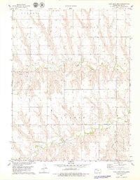
1978 Map of Achilles SE
USGS Topo · Published 1979About this map
South Fork Sappa Creek carves a deep valley across this High Plains landscape in the late 1970s, where the borders of Rawlins and Thomas counties meet. The map reveals a sparse but deliberate agricultural settlement pattern, anchored by the Townhall in section 9 and the small community of Falconer. This era in western Kansas saw continued diversification of land use, evidenced by the presence of numerous wells and an Oil Well in the northeastern corner of the sheet. The drainage systems of North Fork Prairie Dog Creek and Prairie Dog Creek dictate the local topography, creating the undulating terrain of Jefferson and Wendell townships. This survey is particularly useful for genealogists and local historians interested in the exact placement of early rural infrastructure and land management during a period of modern agricultural development.
Find a feature on this map
11 named features on this map. Tap any name to fly to it.
Don’t see what you’re looking for? This feature index may not catch every label — zoom into the map to look around manually.
Map Details
Editions of this 1978 Achilles SE Map
This is the sole edition of this map. No revisions or reprints were ever made.
Other maps of this area

1951 · Selden
USGS Topo · 1:62,500

1951 · Achilles
USGS Topo · 1:62,500

1954 · Goodland
USGS Topo · 1:250,000

1956 · Goodland
USGS Topo · 1:250,000

1957 · Goodland
USGS Topo · 1:250,000

1965 · Achilles
USGS Topo · 1:24,000

1965 · Selden NW
USGS Topo · 1:24,000

1978 · Long Draw South
USGS Topo · 1:24,000

1978 · Selden SW
USGS Topo · 1:24,000
1978 · Long Draw North
USGS Topo · 1:24,000