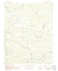
1992 Map of Ackerson Mountain
USGS Topo · Published 1995About this map
Yosemite National Park and the adjacent Stanislaus National Forest converge on this map, highlighting a transition from managed timberlands and early settlements to protected wilderness. The area around Hazel Green Ranch and the Tuolumne Grove marks a historic intersection of early travel routes and natural monuments, featuring the noted Tunnel Tree. The landscape is defined by the deep canyons of the Tuolumne River and its forks, which influenced the placement of early outposts like Peach Growers and the Carlon FS Station. To the south, Big Oak Flat Road provides a corridor through the high country, connecting the Big Oak Flat Entrance Station to high-elevation points like Gin Flat and the Crane Flat Lookout. The presence of the Yosemite Wilderness boundary reflects a commitment to preserving the drainage basins of Ackerson Creek and Crane Creek in their natural state.
Find a feature on this map
40 named features on this map. Tap any name to fly to it.
Don’t see what you’re looking for? This feature index may not catch every label — zoom into the map to look around manually.
Map Details
Editions of this 1992 Ackerson Mountain Map
This is the sole edition of this map. No revisions or reprints were ever made.
Other maps of this area

1897 · Yosemite
USGS Topo · 1:125,000

1900 · Yosemite
USGS Topo · 1:125,000

1903 · Yosemite
USGS Topo · 1:125,000

1909 · Yosemite
USGS Topo · 1:125,000

1947 · El Portal
USGS Topo · 1:24,000

1947 · Mariposa
USGS Topo · 1:250,000

1947 · El Portal
USGS Topo · 1:62,500
1947 · Kinsley
USGS Topo · 1:24,000

1948 · Mariposa
USGS Topo · 1:250,000
1949 · Kinsley
USGS Topo · 1:24,000