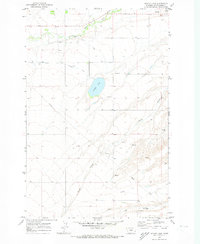
1970 Map of Ackley Lake
USGS Topo · Published 1973About this map
Ackley Lake serves as the central focal point for this Judith Basin landscape, where early 1970s irrigation infrastructure is clearly visible. The map details the intricate water management system of the era, including the Ackley Lake Feeder Canal, Ackley Lake Outlet Canal, and the Murray Ditch, which redirect water from the Judith River to support local agriculture. This network reveals the systematic effort to manage the high plains terrain and its seasonal springs.
Find a feature on this map
18 named features on this map. Tap any name to fly to it.
Don’t see what you’re looking for? This feature index may not catch every label — zoom into the map to look around manually.
Map Details
Editions of this 1970 Ackley Lake Map
This is the sole edition of this map. No revisions or reprints were ever made.
Other maps of this area

1886 · Little Belt Mts.
USGS Topo · 1:250,000

1889 · Big Snowy Mountain
USGS Topo · 1:250,000

1890 · Fort Benton
USGS Topo · 1:250,000

1892 · Fort Benton
USGS Topo · 1:250,000

1893 · Big Snowy Mountain
USGS Topo · 1:250,000

1894 · Little Belt Mts.
USGS Topo · 1:250,000

1897 · Fort Benton
USGS Topo · 1:250,000

1897 · Little Belt Mts.
USGS Topo · 1:250,000

1898 · Little Belt Mts.
USGS Topo · 1:250,000

1902 · Little Belt Mts.
USGS Topo · 1:250,000