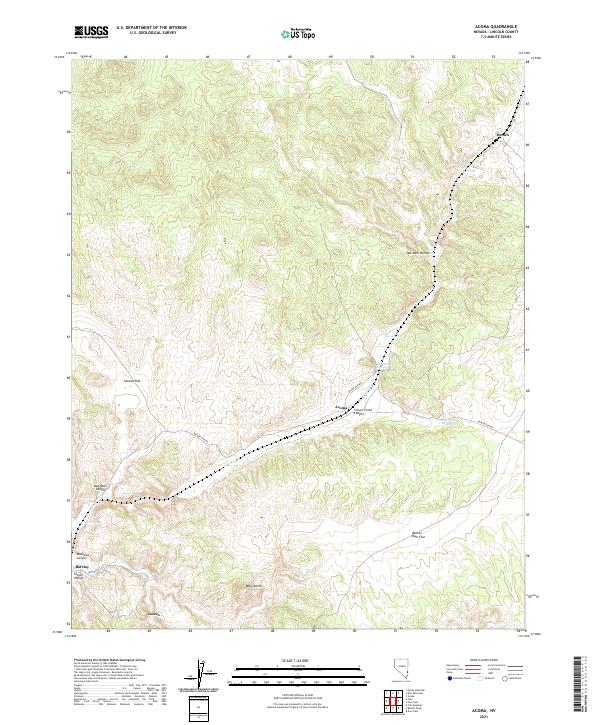
2021 Map of Acoma
USGS Topo · Published 2021About this map
Clover Cr and its deep-cut canyons form the central spine of this Lincoln County landscape, where small desert settlements like Acoma and Barclay trace the corridor of the Union Pacific Railroad. The terrain transitions from the high, flat expanses of Panaca Flat and Beaver Dam Flat into rugged breaks such as Oak Well Canyon and Mathews Canyon. This 2021 survey illustrates a region defined by its water sources, including Acoma Spring and the Acoma Reservoir, which have historically supported ranching and transit in the arid Clover Valley. Further south, the map identifies the vicinity of Joseco and the prominent rising terrain of the Bally Knolls. The road network is sparse, centered primarily on Beaver Dam Rd and Mustang Rd, highlighting the isolation and topography of this eastern Nevada frontier.
Find a feature on this map
25 named features on this map. Tap any name to fly to it.
Don’t see what you’re looking for? This feature index may not catch every label — zoom into the map to look around manually.
Map Details
Editions of this 2021 Acoma Map
This is the sole edition of this map. No revisions or reprints were ever made.
Other maps of this area

1885 · Pioche
USGS Topo · 1:250,000

1886 · Pioche
USGS Topo · 1:250,000

1954 · Caliente
USGS Topo · 1:250,000

1958 · Docs Pass
USGS Topo · 1:24,000

1959 · Caliente
USGS Topo · 1:250,000
1972 · Uvada
USGS Topo · 1:24,000
1972 · Mosey Mtn
USGS Topo · 1:24,000
1972 · Acoma
USGS Topo · 1:24,000
1972 · Dow Mountain
USGS Topo · 1:24,000
1972 · Pine Park
USGS Topo · 1:24,000