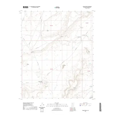
2020 Map of Acoma Pueblo
USGS Topo · Published 2020About this map
Acoma Village stands as the central settlement in this high-desert landscape of Cibola County, where ancient geology and tribal history intersect. The terrain is defined by dramatic sandstone formations and mesas, including the prominent Mesa Encantada and the expansive Woods Mesa. Water sources are vital but sparse in this environment, represented here by Acoma Springs and the seasonal path of Acoma Cr. Landmarks with evocative names such as Eye of the Moon, Dinosaur Rock, and Deadmans Rock serve as distinct navigational points across the territory. The map details a network of indigenous service routes, including Indian Svc Rte 22 and Indian Svc Rte 284, which connect the village to the surrounding valley and mesa tops. This 2020 survey documents the enduring spatial layout of the pueblo and its surrounding natural monuments, from Rabbit Butte in the north to Southwest Plaza and Petoch Butte at the southern edge.
Find a feature on this map
31 named features on this map. Tap any name to fly to it.
Don’t see what you’re looking for? This feature index may not catch every label — zoom into the map to look around manually.
Map Details
Editions of this 2020 Acoma Pueblo Map
This is the sole edition of this map. No revisions or reprints were ever made.
Other maps of this area

1883 · Mt. Taylor
USGS Topo · 1:250,000

1886 · Mt. Taylor
USGS Topo · 1:250,000

1892 · Mt. Taylor
USGS Topo · 1:250,000

1899 · Mt. Taylor
USGS Topo · 1:250,000

1917 · Cerro Verde
USGS Topo · 1:125,000

1917 · Broom Mountain
USGS Topo · 1:125,000

1954 · Socorro
USGS Topo · 1:250,000

1957 · Laguna
USGS Topo · 1:24,000

1957 · Mc Cartys
USGS Topo · 1:24,000

1957 · Cubero
USGS Topo · 1:24,000