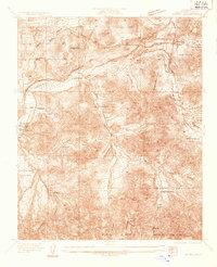
1934 Map of Acton
USGS Topo · Published 1934About this map
Acton stands as a focal point in the upper reaches of the San Gabriel Mountains, where the Southern Pacific Railroad cuts through the high desert landscape. Surveyed in 1934 by H. H. Hodgson and C. P. McKinley, this map reveals a ranching economy defined by scattered holdings like Strong Ranch, Maine-Smith Ranch, and Blum Ranch. These family-named sites are connected by the Soledad Highway and various unnamed roads that follow the natural drainage of Soledad Canyon and Arrastre Canyon.
Find a feature on this map
34 named features on this map. Tap any name to fly to it.
Don’t see what you’re looking for? This feature index may not catch every label — zoom into the map to look around manually.
Map Details
Editions of this 1934 Acton Map
This is the sole edition of this map. No revisions or reprints were ever made.
Other maps of this area

1900 · Tujunga
USGS Topo · 1:62,500

1901 · Southern California Sheet No. 1
USGS Topo · 1:250,000

1904 · Southern California Sheet No. 1
USGS Topo · 1:250,000

1915 · Elizabeth Lake
USGS Topo · 1:125,000

1917 · Elizabeth Lake
USGS Topo · 1:125,000

1930 · Ravenna
USGS Topo · 1:24,000

1930 · Pearland
USGS Topo · 1:24,000

1932 · Red Rover
USGS Topo · 1:24,000

1932 · Palmdale
USGS Topo · 1:24,000

1934 · Pearland
USGS Topo · 1:24,000