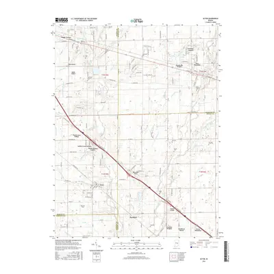
2016 Map of Acton
USGS Topo · Published 2016About this map
Acton and New Palestine anchor this survey of the southeastern edges of Marion County and its neighbors, Hancock and Shelby. The landscape is defined by the drainage basins of Buck Creek and Sugar Creek, where a dense network of suburban developments like Belle Arbor and Indian Creek Estates meets older rural settlements. The map is particularly valuable for its record of family-named cemeteries and early landmarks, such as the Buck Creek Christian Cem and Schildmeier Cem, which sit among modern residential expansions. Transportation is dominated by the diagonal corridor of Southeastern Ave and Interstate 74, which bisect the grid of county roads. These transit lines link smaller communities such as Brookfield and Pleasant View, showing the transition from agricultural fields to the growing residential footprint of the Indianapolis metropolitan area in the mid-2010s.
Find a feature on this map
126 named features on this map. Tap any name to fly to it.
Don’t see what you’re looking for? This feature index may not catch every label — zoom into the map to look around manually.
Map Details
Editions of this 2016 Acton Map
This is the sole edition of this map. No revisions or reprints were ever made.
Other maps of this area

1948 · Indianapolis East
USGS Topo · 1:24,000

1948 · Beech Grove
USGS Topo · 1:24,000

1952 · Cumberland
USGS Topo · 1:24,000

1952 · Greenfield
USGS Topo · 1:24,000

1952 · Fountaintown
USGS Topo · 1:24,000

1953 · Greenwood
USGS Topo · 1:24,000

1953 · Shelbyville
USGS Topo · 1:24,000

1953 · Acton
USGS Topo · 1:24,000

1953 · Boggstown
USGS Topo · 1:24,000

1953 · Cincinnati
USGS Topo · 1:250,000