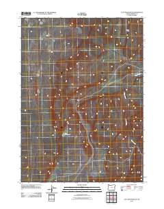
2011 Map of Acty Mountain NE
USGS Topo · Published 2011About this map
Basque Hills define the northern terrain of this remote corner of Harney County, illustrating the high-desert character of the Oregon landscape. In a region where water is a critical resource for ranching and wildlife, the Red Waterhole serves as a notable landmark amidst the high-elevation flats. The southern portion of the quadrangle is etched by the drainage of Canyon Creek, which cuts through the topography as it flows eastward. This 2011 survey, produced by the U.S. Geological Survey, maps a sparsely populated area where the road network consists primarily of local tracks and four-wheel-drive trails, reflecting a landscape still shaped by traditional land use and natural drainage patterns.
Find a feature on this map
3 named features on this map. Tap any name to fly to it.
Don’t see what you’re looking for? This feature index may not catch every label — zoom into the map to look around manually.
Map Details
Editions of this 2011 Acty Mountain NE Map
This is the sole edition of this map. No revisions or reprints were ever made.
Other maps of this area

1955 · Adel
USGS Topo · 1:250,000

1957 · Adel
USGS Topo · 1:250,000

1958 · Adel
USGS Topo · 1:250,000

1962 · Adel
USGS Topo · 1:250,000

1971 · Square Mountain
USGS Topo · 1:24,000
1971 · Acty Mountain NW
USGS Topo · 1:24,000

1971 · Surveyors Lake
USGS Topo · 1:24,000

1971 · Coyote Gap SE
USGS Topo · 1:24,000
1971 · Acty Mountain NE
USGS Topo · 1:24,000
1971 · Hawks Mountain
USGS Topo · 1:24,000