
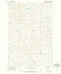
1964 Map of Ada Creek
USGS Topo · Published 1967About this map
Big Dry Creek and its many meandering tributaries define this mid-1960s landscape in Garfield County. The drainage network is dense and intricate, with Ada Creek, Frazier Creek, and Sonny Coulee carving out a complex system of draws and coulees. Human presence is sparse, centered around the Mahoney Ranch and the Viall Sch, reflecting the region's ranching heritage. Two distinct spillway structures, including one at Spillway Elev 2622, suggest engineered water management efforts amidst the seasonal flow of Spring Draw. This survey captures the isolated character of the plains before modern consolidation altered the footprint of local rural school districts and small family ranching operations.
Find a feature on this map
13 named features on this map. Tap any name to fly to it.
Don’t see what you’re looking for? This feature index may not catch every label — zoom into the map to look around manually.
Map Details
Editions of this 1964 Ada Creek Map
This is the sole edition of this map. No revisions or reprints were ever made.
Other maps of this area

1954 · Jordan
USGS Topo · 1:250,000

1956 · Jordan
USGS Topo · 1:250,000

1958 · Jordan
USGS Topo · 1:250,000

1964 · Jordan
USGS Topo · 1:250,000

1964 · Bateman Coulee
USGS Topo · 1:24,000

1964 · Black John Coulee
USGS Topo · 1:24,000

1964 · Bateman Coulee NE
USGS Topo · 1:24,000
1965 · York Reservoir
USGS Topo · 1:24,000

1965 · Hafla School
USGS Topo · 1:24,000
1965 · Cohagen NE
USGS Topo · 1:24,000