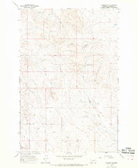
1965 Map of Cohagen NE
USGS Topo · Published 1969About this map
The high plains of eastern Montana's Garfield County are depicted here through a network of seasonal watercourses and primitive tracks, reflecting the sparse, utilitarian landscape of the mid-1960s. The terrain is defined by the drainage patterns of Taylor Creek and Longs Fork, where deep coulees and erosional features create a complex topography typical of the Missouri River breaks region. One of the most distinctive human imprints on this landscape is the Two Furrow Road, a specific type of prairie track that marks the transition between open range and established section lines. The map also captures several smaller drainages like Skunk Arroyo and Duck Creek, which serve as vital landmarks in an otherwise repeating landscape of ridges and springs. This survey highlights the intersection of natural drainage and the early road network that supported ranching operations between the townships of T. 17 N. and T. 16 N.
Find a feature on this map
9 named features on this map. Tap any name to fly to it.
Don’t see what you’re looking for? This feature index may not catch every label — zoom into the map to look around manually.
Map Details
Editions of this 1965 Cohagen NE Map
This is the sole edition of this map. No revisions or reprints were ever made.
Other maps of this area

1954 · Jordan
USGS Topo · 1:250,000

1956 · Jordan
USGS Topo · 1:250,000

1958 · Jordan
USGS Topo · 1:250,000

1964 · Jordan
USGS Topo · 1:250,000

1964 · Ada Creek
USGS Topo · 1:24,000

1964 · Black John Coulee
USGS Topo · 1:24,000

1965 · Cohagen
USGS Topo · 1:24,000

1965 · Calamity Coulee
USGS Topo · 1:24,000
1965 · York Reservoir
USGS Topo · 1:24,000

1965 · Hafla School
USGS Topo · 1:24,000