
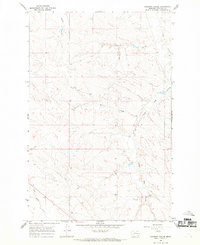
1965 Map of Calamity Coulee
USGS Topo · Published 1968About this map
Calamity Coulee and its neighboring drainages define the landscape of Garfield County in the mid-1960s, a period when this part of the Montana plains remained dominated by wide-open ranching country. The map captures a complex network of intermittent streams and coulees, including the winding Little Dry Creek and the curiously named Nighten-Heiser Coulee. A lone Cem (cemetery) located near Witchie Coulee provides a focal point for genealogical interest, representing the small, localized burial sites typical of early homesteading families in this region. The absence of major settlements highlights the land's orientation toward livestock and dryland utility, with features like Skunk Arroyo and Thompson Creek serving as the primary landmarks in an area defined by its hydrology and property fence lines.
Find a feature on this map
15 named features on this map. Tap any name to fly to it.
Don’t see what you’re looking for? This feature index may not catch every label — zoom into the map to look around manually.
Map Details
Editions of this 1965 Calamity Coulee Map
This is the sole edition of this map. No revisions or reprints were ever made.
Other maps of this area

1954 · Jordan
USGS Topo · 1:250,000

1954 · Forsyth
USGS Topo · 1:250,000

1956 · Jordan
USGS Topo · 1:250,000

1957 · Forsyth
USGS Topo · 1:250,000

1958 · Jordan
USGS Topo · 1:250,000

1958 · Forsyth
USGS Topo · 1:250,000

1964 · Jordan
USGS Topo · 1:250,000

1965 · Cohagen
USGS Topo · 1:24,000

1965 · Whiteside Ranch
USGS Topo · 1:24,000
1965 · Coleman Coulee
USGS Topo · 1:24,000