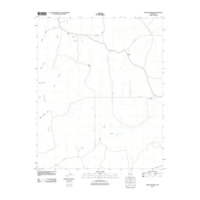
2010 Map of Adams Diggings
USGS Topo · Published 2010About this map
Adams Diggings serves as the focal point of this arid Catron County landscape, a name synonymous with one of the most enduring legends of lost gold in New Mexico history. This early 21st-century survey documents the area's sparse high-desert settlement pattern, where small points like Kalberg, Hogg, and Wade mark the vast stretches of ranching country. The terrain is characterized by massive features such as Mariano Mesa and Toms Rock, which overlook a network of seasonal drainages including Nations Draw, Techado Draw, and Sweazea Draw. Infrastructure is limited to essential connectors like Graveyard Rd and Omega Rd, which link remote homesteads to the Forest Hill Cemetery. This document provides a clear look at the region’s topography before contemporary developments, capturing the isolation of features like Cat Lake and the broad Techado Flat.
Find a feature on this map
25 named features on this map. Tap any name to fly to it.
Don’t see what you’re looking for? This feature index may not catch every label — zoom into the map to look around manually.
Map Details
Editions of this 2010 Adams Diggings Map
This is the sole edition of this map. No revisions or reprints were ever made.
Other maps of this area

1954 · Saint Johns
USGS Topo · 1:250,000

1957 · Saint Johns
USGS Topo · 1:250,000

1958 · Saint Johns
USGS Topo · 1:250,000

1962 · Saint Johns
USGS Topo · 1:250,000

1967 · Omega
USGS Topo · 1:24,000

1967 · Mariano Springs
USGS Topo · 1:24,000

1967 · Adams Diggings
USGS Topo · 1:24,000

1967 · Blue Hills
USGS Topo · 1:24,000
1967 · Pie Town
USGS Topo · 1:24,000

1967 · Veteado Mountain
USGS Topo · 1:24,000