
1967 Map of Mariano Springs
USGS Topo · Published 1971About this map
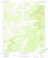
Mariano Springs and the expansive Mesa Mariano dominate this section of Catron County, where water sources dictated the patterns of ranching and movement. The map documents numerous vital watering points, including Cottonwood Spring, Baca Spring, and Cole Spring, alongside several named wells and tanks such as Tarpley Well and Franklin Tank. These features were essential for survival in the arid high-desert environment of west-central New Mexico.
Find a feature on this map
27 named features on this map. Tap any name to fly to it.
Don’t see what you’re looking for? This feature index may not catch every label — zoom into the map to look around manually.
Map Details
Editions of this 1967 Mariano Springs Map
2 editions found
Other maps of this area

1954 · Saint Johns
USGS Topo · 1:250,000

1957 · Saint Johns
USGS Topo · 1:250,000

1958 · Saint Johns
USGS Topo · 1:250,000

1962 · Saint Johns
USGS Topo · 1:250,000

1967 · Omega
USGS Topo · 1:24,000

1967 · Adams Diggings
USGS Topo · 1:24,000

1967 · Veteado Mountain
USGS Topo · 1:24,000

1967 · Quemado
USGS Topo · 1:24,000
1967 · Techado
USGS Topo · 1:24,000

1972 · Tejana Mesa
USGS Topo · 1:24,000