
1967 Map of Adams Diggings
USGS Topo · Published 1971About this map
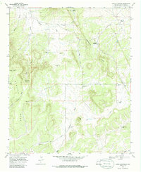
The Continental Divide winds through this high-altitude landscape of western New Mexico, where the settlement of Adams Diggings and the presence of Indian Ruins suggest a long history of human occupation. This 1960s survey documents a livestock and ranching economy dependent on numerous remote water sources, including the Techado Spring and several family-named improvements such as Lee Wright Well, Taylor Well, and Daddy Haynes Well.
Find a feature on this map
36 named features on this map. Tap any name to fly to it.
Don’t see what you’re looking for? This feature index may not catch every label — zoom into the map to look around manually.
Map Details
Editions of this 1967 Adams Diggings Map
2 editions found
Other maps of this area

1954 · Saint Johns
USGS Topo · 1:250,000

1957 · Saint Johns
USGS Topo · 1:250,000

1958 · Saint Johns
USGS Topo · 1:250,000

1962 · Saint Johns
USGS Topo · 1:250,000

1967 · Omega
USGS Topo · 1:24,000

1967 · Mariano Springs
USGS Topo · 1:24,000

1967 · Blue Hills
USGS Topo · 1:24,000
1967 · Pie Town
USGS Topo · 1:24,000

1967 · Veteado Mountain
USGS Topo · 1:24,000
1967 · Trail Lake
USGS Topo · 1:24,000