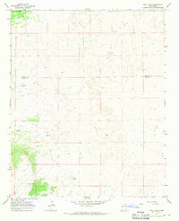
1967 Map of Trail Lake
USGS Topo · Published 1971About this map
Cerro Gatos rises above a high desert plateau in this 1960s landscape, defined by a critical network of water management features essential for ranching and survival. The map details the boundary between Valencia and Catron counties, showing a region where life revolved around scattered catchment points and seasonal basins. Notable water sources such as Canteen Lake and Trail Lake are documented alongside developed landmarks like Tusas Corral. The infrastructure of the era is preserved through precisely located family-named and descriptive features, including Ramon Well, Viuda Well, and Katy Bess Well, providing a look at how this arid environment was navigated and utilized before modern developments.
Find a feature on this map
9 named features on this map. Tap any name to fly to it.
Don’t see what you’re looking for? This feature index may not catch every label — zoom into the map to look around manually.
Map Details
Editions of this 1967 Trail Lake Map
This is the sole edition of this map. No revisions or reprints were ever made.
Other maps of this area

1954 · Saint Johns
USGS Topo · 1:250,000

1957 · Saint Johns
USGS Topo · 1:250,000

1958 · Saint Johns
USGS Topo · 1:250,000

1962 · Saint Johns
USGS Topo · 1:250,000
1967 · Tres Lagunas
USGS Topo · 1:24,000
1967 · York Ranch SE
USGS Topo · 1:24,000

1967 · Adams Diggings
USGS Topo · 1:24,000

1967 · Blue Hills
USGS Topo · 1:24,000
1967 · York Ranch
USGS Topo · 1:24,000

1967 · Veteado Mountain
USGS Topo · 1:24,000