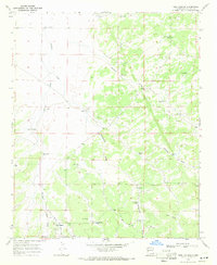
1967 Map of Tres Lagunas
USGS Topo · Published 1971About this map
High-altitude grazing and water management define this New Mexico landscape during the mid-1960s. The terrain is heavily marked by a network of drainage systems, including the prominent Veteado Draw and Homestead Draw, which dictated the placement of isolated ranching outposts. Small-scale settlements and seasonal locations like Tres Lagunas and Veteado Camp serve as the primary human centers, supported by a sophisticated array of water infrastructure such as Stuart Station Well and Schoolhouse Tank.
Find a feature on this map
29 named features on this map. Tap any name to fly to it.
Don’t see what you’re looking for? This feature index may not catch every label — zoom into the map to look around manually.
Map Details
Editions of this 1967 Tres Lagunas Map
This is the sole edition of this map. No revisions or reprints were ever made.
Other maps of this area

1917 · Broom Mountain
USGS Topo · 1:125,000

1954 · Saint Johns
USGS Topo · 1:250,000

1954 · Socorro
USGS Topo · 1:250,000

1957 · Saint Johns
USGS Topo · 1:250,000

1958 · Socorro
USGS Topo · 1:250,000

1958 · Saint Johns
USGS Topo · 1:250,000

1962 · Socorro
USGS Topo · 1:250,000

1962 · Saint Johns
USGS Topo · 1:250,000

1964 · Third Canyon
USGS Topo · 1:24,000
1964 · Bonine Canyon
USGS Topo · 1:24,000